Saturday, September 5, 2009

Sapt-Konkan - Parashuram Shristi

Sunday article by Mohan Pai

Hello friends,

Good morning. This morning's topic is Sapt-Konkan, the coastal ecoregion of the Western Ghats, defined by the Purana's as Sapt-Konkan or "Parashuram Shristi". And there is a legend about it.

The Western Ghats, older than the Himalayas, have a fascinating geological history. They are the most important feature of the landscape of the southern peninsula and in these same hills we confront our future. Unfortunately they continue to suffer drastic degradation due to human pressure.I have been writing about these mountain ranges for quite some time now. My book "The Western Ghats" was published in 2005. Most of the writings could be accessed in the links given below:For some key chapters from my book "The Western Ghats", please log on to:

http://westernghats-paimohan.blogspot.com/

For detailed blog (6 Chapters from my book) on Mahadayi/Mandovi River Valley, please log on to:http://mohan-pai.blogspot.com/

For biospoheres & bioregions of the Western Ghats please log on to:

http://biodiversity-mohanpai.blogspot.com/2008/10/nilgiri-biosphere-reserve.htmlhttp://biodiversity-mohanpai.blogspot.com/2008/10/high-ranges.htmlhttp://biodiversity-mohanpai.blogspot.com/2008_11_01_archive.htmlhttp://biodiversity-mohanpai.blogspot.com/2008/12/biodiversity-kodagu-coorg.html

Very best wishes,

Mohan Pai


WESTERN GHATS COASTAL ECOREGION


SAPT-KONKAN
The Emerald Country


Honda, Sattari, Goa - pic by Mohan Pai

'Parashuram Shristi'
Konkan, Goa & Karavali


The precise definition of Konkan varies, but most include Maharashtra's districts of Raigad, Mumbai, Thane, Ratnagiri and Sindhudurg, the state of Goa, and the Uttar Kannada, Udupi and Dakshina Kannada districts of Karnataka. Sapt-Konkan is also known as ‘Parashuram Shirsti’; according to the legend, Lord Parashuram, the sixth incarnation of Lord Vishnu stood atop the Sahyadri and shot an arrow into the roaring sea and beyond and created the coastal tract. The Sapta-Konkan as depicted in Skanda-purana stretches from Maharashtra to Karnataka . This is actually logical since there are a lot of similarities in the food-habits (rice and fish), crops cultivated (rice, mangoes, cashews and jackfruit) and the physique (tall and well-built) of people dwelling in this area. Konkan Division is also one of six administrative sub-divisions of the state of Maharashtra, comprising of its costal districts.


Sage Parashuram, a painting


Konkan Ecoregion
An ecoregion is defined as a large area of land or water that contains geographically distinct assemblage of natural communities that
a) share a large majority of their species and ecological dynamics;
b) share similar environmental conditions, and;
c) interact ecologically in ways that are critical for their long term persistence.
Based on these criteria, Konkan division of Maharashtra, Goa and Karavali region of Karnataka form one homogenous ecoregion. Biodiversity ignores national and other political boundaries, so a more relevant conservation planning unit is required.


From the Imperial Gazeteer of India (1907-1909)


Konkan.— A name applied to the Marathi-speaking lowland strip along the southern portion of the Bombay Presidency, situated between the Western Ghats and the sea. The term has no very distinct ad- ministrative signification, and its former geographical limits have become less strictly defined than of old. The coast strip, to which the word is now applied, is a fertile and generally level tract, varying from 1 or 2 to about 50 miles in breadth between the sea and the mountains, with an area of about 12,500 square miles, and, approximately, a population of 3,800,000. It is watered by hill streams, and at parts intersected by tidal backwaters, but has nowhere any great rivers. A luxuriant vegetation of palms rises along the coast, the cocoa-nut plantations forming an important source of wealth to the villagers. Splendid forests cover the Ghats on its eastern boundary. The crops are abundant ; and owing to the monsoon rainfall being precipitated upon the Ghats behind, the Konkan is peculiarly exempt from drought and famine. The common language of the Konkan is Marathi. Kanarese is spoken in the southern part, and a little Gujarathi in the north of Thana. In a geographical sense, the Konkan forms one of the five territorial Divisions of the Bombay Presidency, the others being the Deccan, the Karnatik, Gujarat, and Sind. It includes the town and island of Bombay, the three British Districts of Ratnagiri, Kolaba, and Thana, the three Native States of Jawhar, Janjira, and Sawantwari, and the Portuguese territory of Goa ......The Konkan is bounded by Gujarat on the north, by the Deccan on the east, by North Kanara District on the south, and by the Arabian Sea on the west. The history of the Konkan will best be gathered from a perusal of the historical portions of the separate articles on the included States and Districts. The earliest dynasty connected with the Konkan is that of the Mauryas, who reigned about three centuries before Christ; but the "evidence of the connection rests altogether on vol. viii. T 290 KONKAN, an Asoka inscription discovered at the town of Sopara in Thana District. The dynasties that succeeded were the following, in their order, so far as order is ascertainable : — The Shatakarnis or Andrabhrityas, with their capital at Paitan in the Deccan ; the Mauryas, descendants of the elder house ; the Chalukyas ; the Silaharas, whose capital was perhaps the island of Elephanta in Bombay Harbour ; the Yadavas, with their capital at Deogiri, the modern Daulatabad ; the Muhatn- madans (Khiljis, Bahmanis, Bijapur chiefs, Mughals, and Ahmadabad kings) ; Portuguese commanders (over a limited area) ; Marathas ; and British. The principal incidents in the annals of the Konkan are of modern interest. The Konkan coast was known to the peoples of Greece and Rome, and both Ptolemy (150 a.d.) and the author of the Periplus (247 a.d.) afford evidence that Greek traders from Egypt dealt with the Konkan ports. Many of these last are named by the Greek geographers ; and while the modern representative of the ancient town has been in many instances identified, in others the ingenuity of conjecture is still employed. To take one or two examples, it is yet a matter of uncertainty whether Byzantium is the Konkan pirate fort of Vijayadrug ; whether the word Chersonesus refers to Goa, or whether the term Heptanesia relates to the islands that stud the modern harbour of Bombay. The arrival of the Beni-Israel and the Parsis from the Persian Gulf and Persia are important incidents in Konkan history. The Beni-Israel, whom high authority has not hesitated to call the descendants of the lost tribes of Israel, are found all over Bombay Presidency. The descendants of the first Parsis, who landed in Thana about the 7th century, now crowd the streets and markets of Bombay, engross a large part of the city's wealth and principal trading operations, and have their agents in all important provincial towns.


Vasco da Gama landing at Kappad.


The Portuguese reached Malabar in 1498, and fixed the head-quarters of their naval dominion at Cheul or Chaul. In 1510, Goa was seized, and from this time until 1630 the Portuguese shared the rule of the Konkan with the Muhammadan kings of Ahmadnagar and Bijapur. The rise and fall of the pirate power of the Angres, who fixed themselves in the island strongholds of Kolaba, Suvarndriig, and Gheria or Vijayadrug, and from 1700 to 1756 harassed English, Dutch, and native shipping alike, mark a disastrous period of Konkan history. Since the British administration was set up in 1818 on the overthrow of the Marathas, the peace of the whole area, if some disturbances in Sawantwari in 1844 and 1850 be excepted, has remained unbroken. The great city and harbour of Bombay are situated about one-third down the length of the Konkan from the north. The Portuguese territory of Goa used to form its southern limit ; but the District of North Kanara has been transferred from Madras to the Bombay Pi and now constitutes the southernmost District of the D as the Konkan.


Imperial Gazetteer map of Konkan

Physical Aspects, Natural History, and Geology.- -The folio paragraphs have been condensed from a short mon<>Climate & Vegetation

The climate of the Sapt-Konkan shows two rainfall gradients.
The West-East Gradient
The west-east rainfall gradient is determined by the effect of Ghats’ escarpment. The reliefs of the Ghats act as a barrier to the eastward movement of the cloud masses brought by the summer monsoon rain-bearing winds of the south-west monsoon.
These masses bring prodigious amount of rainfall over the western slopes of the Ghats. For instance in Agumbe (height 645 m) which is situated at the edge of the Ghats, the mean annual rainfall is 7,460 mm, and in some years it exceeds 12,000 mm in only 130 rainy days. Overall the western slopes receive 2,000 to 7,500 mm of rainfall.

Once this obstacle is crossed, the rainfall decreases rapidly to <>
The South-North Gradient
An important feature of the Western Ghats is that they form more or less continuous chain of hills with a latitudinal extent of almost 12 degrees. This has few parallels in the tropical world(eastern part of Madagascar and Queensland in Australia). The monsoon, the very pulse of India, adds yet another dimension : the duration of the dry season gradually increases from two months in the southern parts of the Ghats to over eight months north of Mumbai. This gradient is determined by the arrival and withdrawal of the summer monsoon.
The monsoon generally arrives towards the end of May at the southern tip of India, in the first week of June at Tiruvananthpuram, five days later it reaches Karwar, in another five days it has already crossed Mumbai and by middle of June it is beyond Kutch. Thus it takes only 10-15 days to cover the Indian peninsula from 80 N to the Tropic of Cancer.
The monsoon begins to retreat by the end of September in north India but it takes nearly 15 days for the front to withdraw from Kutch to Ratnagiri which it reaches in the beginning of October, in another 15 days it covers 400 km, the distance separating Ratnagiri from Coondapur. The front passes through Mangalore at the beginning of November and Kozikode in a fortnight, and reaches Kanyakumari only in early December. Thus the withdrawal is spread over a period of nearly two and a half months. The advance and specially the gradual withdrawal of the monsoon leads to a reduction in the rainy period from south to north and consequently a concomitant lengthening of dry season. This gradient is one of the key factors for understanding the variations in the floristic composition along the Ghats.
Vegetation Types
Wet Evergreen Forests
Wet evergreen forests are mostly confined to the windward side of the Ghats where the rainfall exceeds 2,000 mm. The deep valleys on the western windward side nurture closed canopy, stratified evergreen forests. These are arranged in a series of tiers. Each tier receives a different amount of light; the tallest trees are bathed in perpetual sunlight, smaller trees and shrubs receive dappled light. The forest floor is almost in complete darkness. The canopy is supposed to be closed because the contiguous crown of tall buttressed trees merge to form a veritable roof. Occasionally, giant trees termed as emergents push through the canopy to obtain dominant position. Light, temperature and humidity differ at different heights beneath the canopy. Two or more strata of shade loving trees find the appropriate level at which light intensity and relative humidity are best suited for their metabolic activities.
The density of growth in these hot and humid jungles is so great that over 70 tall trees can exist in one hectare. These trees may be 35-45 m high and have evolved small narrow leaves to minimise moisture loss through evaporation. The lower growing plants have larger leaves in order to maximise the benefit of the little light that manages to penetrate. At every level, leaves tend to be narrow with drain-like tips so that the monsoon water flows off efficiently. This makes it possible for the leaf to remain relatively dry and ‘breath The forests are in leaf throughout the year and hence termed evergreen. These trees shed their leaves at a slow and steady rate throughout the year, which results in continuous decay and decomposition on the forest floor which is full of leaf litter and decaying wood on which mushrooms, lichen and fungi thrive. In the relative gloom of the forest floor herbs are frequent with good representative of gingers and orchids. Climbers and lianas supported by sturdy trees, spiral towards the canopy in search of better light and fresh air..

Dry Evergreen Forests
The steep eastern slopes of the Ghats where the rainfall is less than 1,500 mm harbour dry vegetation types. However, in the relatively moist valleys and along streams, forests are evergreen and distinct in floristic composition with its counterpart on the western side. Physiognomic structure of these forests varies according to moisture level of the soil. Generally they are short forests, with a canopy seldom higher than 12 m, and with two strata.

Moist Deciduous forests
Moist deciduous forests, which are in primary nature, are found in the rainfall zone of 1,500 mm to 1,800 mm; as a transition between wet evergreen and dry deciduous forests. Large extent of these forests occurs in the Wayanad, Mysore and Karnataka plateau. Moist deciduous forests also occur within the potential area of wet evergreen formations, where the rainfall is more than 2,000 mm. Its very presence in the zone indicates their secondary nature after a possible degradation of original wet evergreen forests. On the leeward rain shadow side as well as on the coastal lowlands there are fairly long dry periods. Moist deciduous trees survive the rigours of the dry months by shedding all their leaves simultaneously to avoid loss of water through transpiration.
During the leafless period the trees carry on their reproductive cycle by spectacular flowering followed by abundant fruiting. With the pre-monsoon showers, a flush of fresh leaves appears to herald the beginning of a fresh annual cycle. A number of good timber trees are found in these open canopy forests.
Climatic Variations and Endemics
The high degree of endemism in the evergreen forests of the Western Ghats can be attributed to the isolation of the Ghats from other moist formations and the prevailing drier climatic conditions in the surrounding areas. This isolation seems to have facilitated the process of speciation (formation of new biological species) leading to the phenomenon of vicariance between sister species derived from a common ancestor, one of which thrives in the evergreen forests of the Ghats and the other in the adjacent dry regions (for example Diospyros assimilis in the moist evergreen forests and D. Ebenum in dry forests).
South of Kodagu, the Western Ghats are comprised largely of high ranging hills with several enclaves which formed ideal refugia for certain species when the climatic conditions became drier . Within the Ghats, the variation in the degree of endemism is mainly determined by
a) the increase in the number of dry months from south to north and
b) the decrease in the temperature with increase in altitude. These two gradients also explain the numerous cases of vicariance encountered within the evergreen continuum. Local topographic variations add another dimension to the floristic diversity and endemism.


CASHEW APPLE: The nuts are first removed andprocessed and have a large local as well as exportmarket. The cashew apple is first smashed, and then fermented to be made into the famous liquor- the Cashew Feni.

Traditional Horticulture
The main crops of the traditional horticulture of the region are Coconut, Betel nut, Cashewnut, Banana, Jackfruit, Mango, Bhirand or Kokum, Pineapple and a variety of gourds.
The Kadambas (1000-1350 AD) and later the Governors of Vijayanagar promoted mango orchards in this region. Although crude methods of grafting were already known in India, the Jesuits helped perfect the art of mango grafting in Goa.

Seaside Vegetation & Mangroves
The marshy areas, the swampy places where the sea comes in high tide, or where a river finally empties itself into the ocean, these are the places where many kinds of fish come to spawn. Often these areas are very large; trees do not grow here, for salt water washes over them, or floods them regularly; the loose muddy sand shifts easily, and the only plants which can take hold are mangroves with their long spreading roots. The mangrove bushes prove their worth during a storm, for they break its force; in a rough sea the mangrove belt acts as a ‘buffer’ and prevents erosion and keeps the coastline in tact. The mangrove vegetation has to survive on the scorching, shifting and saline sands. Trailing stems, fleshy leaves, salt excreting glands are some of the aids for their survival. The mangroves in the slushy estuaries have special features to overcome the difficulties of their habitat. The mangrove trees and shrubs anchor themselves against the push and pull of the tides by stilt roots. Air in the marshy soil is meagre. The trees often turn their breathing roots upwards in search of fresh air. The seedlings of mangrove trees remain attached to the parent plant until they have a chance of surviving on their own. They fix themselves like darts in the marshy saline slush to avoid being washed away by the sea until they have a chance of surviving on their own. If we remove the mangroves, the coast is exposed to the danger and damage from storms and rough seas.

A number of factors have been responsible for the depletion of wetland areas, mainly the mangrove forests, along the coasts. Intensive aquacultural development, deforestation, pollution from tankers, domestic waste, agricultural run off and industrial effluents are some of the factors. Most of the surviving mangroves are now confined to West Bengal and the islands in the Bay of Bengal. Some of these have been responsible for the protection of certain endangered species of turtles, crocodiles and the rare fresh water sponge.

Sacred Groves and Sacred Trees
Many traditional societies all over the world revered and worshipped nature and considered certain plants and animals as sacred. India has a long tradition in protecting nature - both plants and animals considered as sacred. Forests have been the lifeline for tribals and other forest dwelling communities since ages. Communities all over India followed the practice of setting aside certain patches of land or forest dedicated to a deity or village God, protected and worshipped.
The forest deities are generally of a primitive nature. Sometimes in the form of unshaped stone lumps smeared with red paint - Kalkai in the Konkan, Kenchamma in South Kanara. They are amongst the fiercest of deities; and breaking even a dead twig in a sacred grove is sure to invite the wrath of the deity. Sacred groves are to be found all over the country and abundantly along the Western Ghats and the west coast. Sacred groves ranged from 50 hectares or

A sacred grove in Goa
more to a few hundred square meters. Some sacred groves have remained in tact till recent times as in the Dakshina Kannada and Udupi districts of Karnataka. These pockets have contributed to the preservation of tropical biological diversity, for several new species of plants which have disappeared from everywhere else have been found to be preserved in the sacred groves. Sacred groves in different areas are locally known by different names. In Maharashtra, they are known as Devarai, Devarakavu in Kodagu, Kavu in Kerala and Kan in Uttara Kannada. In spite of the depletion of forests, some sacred groves still remain in-tact. The sacred groves have contributed to the conservation of nature though in a small measure. There are also sacred ponds attached to temples in many parts of India.
Severity of Threats
The major threats to this ecoregion stem from agriculture, mining, hydroelectric projects, and urban expansion. All of these overarching threats are widespread throughout the bioregion. Most of the commercially valuable trees in this ecoregion have already been harvested (IUCN 1991), and ironically, logging is not a significant threat. The paper pulp, plywood, and fiber industries and sawmills were the major consumers of timber and bamboo in the past. Mining for iron and manganese ore are now large contributors to habitat destruction.
Tree frog
Many of the valleys that supported large stands of species-rich forests have been submerged by reservoirs created by the construction of hydroelectric dams. In addition to this inundation of large areas, the secondary activities associated with dam construction, such as road building, access and encroachment into the intact forests, settlements, and fuelwood collection, have exacerbated habitat loss and degradation. The important riparian habitat is the first to be lost during these development enterprises. Many of the remaining forest patches that harbor endemic species are being converted to rubber, areca, and coffee plantations.Fuelwood and fodder collection, grazing, and collection of nonwood forest products are intensifying as rural populations grow. The grasslands of this ecoregion are highly vulnerable to fire, and frequent fires retard the growth and regeneration of shola forests. The degraded habitat is then colonized by the exotic Lantana camera and Eupatorium odorata, which inhibit regeneration of native vegetation.The prevalence of guns, used for crop protection among the people, encourages widespread poaching.
Gavali tribal woman
The West Coast south of Surat runs parallel to the great escarpment of the Western Ghats for its entire length of about 1,600 km culminating at Cape Comorin. The Sapta-Konkan approximately occupies 900 km of the entire Ghat’s coast. The straight looking coast is however quite jagged, marked by a large number of coves (small sheltered recesses in the coast) and creeks(small tidal inlets or estuaries of small streams). A large number of small streams descend from the precipitous Western Ghats and flow through the narrow coastal plain to open into the Arabian Sea.


A typical view of the Konkan, consisting of white-sand beaches and palm trees (mostly coconut and betel nut).

Although the streams are small, some of them have formed spectacular waterfalls. The Konkan coastal plain is cliffy and there are several shoals, reefs and islands in the Arabian Sea. Mumbai was a large island but parts of the sea have been reclaimed in recent years to connect it with the mainland. There is a submerged forest near Mumbai which suggests that the sea level rose on the Konkan coast not long ago. The coastal plain is dotted with flat-topped hills. Transverse flat-looped spurs come down almost to the shoreline from the edge of the plateau and dip into the sea at Karwar, the northern part of Karnataka. These appear to be abrasional platforms, now dissected by the west flowing streams.

Mahadayi River at Sonal, Goa - pic by Mohan Pai.
Although the Ghats run parallel to the coast, the width of the coastal lowland varies. At Konkan it is about 50 to 60 km wide. From Goa to Kozhikode, the width of the coastal zone is more variable than in Maharashtra.

The Sahyadris dip into the Arabian Sea at Karwar
It is about 40 km wide at the latitude of Goa and then suddenly narrows near Karwar where the Ghats almost meet the sea. To the south of 140N, the coastal zone now called Dakshina Kannada, widens once more to almost 80 km south of Mangalore. The coastal region after Kodagu, known as Malabar, is not more than 30 km wide up to the latitude of Kozhikode. From here it widens out to about 60 km near Palghat Gap.
Satodi falls, Karavali
A Coast of Maritime Legends
The maritime history of the West Coast of India predates the birth of Western Civilisation. The world’s first tidal dock is believed to have been built at Lothal around 2,300 BC during the Harappan civilisation near the present day Mangrol harbour on the Gujarat coast. Even before Alexander, there were references to India in Greek works and India had a flourishing trade with Rome. Roman writer Pliny speaks of Indian traders carrying away large quantities of gold from Rome, in payment for much sought exports such as precious stones, skins, textiles, spices, sandal wood, perfumes, herbs and indigo. It was the lure of spices that attracted traders from the Middle East and Europe to the many trading ports in Sapt-Konkan.

Memorial to Vasco da Gama, Kappad
From the earliest times, the West Coast had developed a considerable shipbuilding industry, specialised in building large vessels. There are several accounts of such activities including that of Marco Polo who has described the Indian built ships. European interest in India has persisted since classical times and for very cogent reasons. Europe had much to derive from India such as spices, textiles and other Oriental products. When direct contact was lost with the fall of Rome and the rise of the Muslims, the trade was carried on through middlemen. In the late Middle Ages it increased with the prosperity of Europe. Spice trade was not solely a luxury trade - spices were needed to preserve meat through the winter (cattle had to be slaughtered in late autumn through lack of fodder in winter) and to combat the taste of decay. Wine, in the absence of ancient or modern methods of maturing, had to be ‘mulled’ with spices. This trade suffered two threats in the later Middle ages. There was the threat of Mongol and Turkish Invasion which interfered with the land route through Egypt, and there was the threat of monopoly shared between the Venetians and Egyptians. The Arabs controlled the spice trade with India since the end of the 12th century AD. During the 15th century Spain and Portugal, the then main maritime powers of Europe initiated a series of expeditions with Royal patronage. While one such voyage led to the discovery of West Indies by Columbus, another voyage brought the Portugese to India, the El Dorado.
Fisher women at Britona, Goa -pic by Mohan Pai

Political divisions
Konkan
The Konkan division is an administrative sub-division of Maharashtra which comprises all the coastal districts of the state with a coastline of about 500 km. The region starts with Damanganga river in the north and extends to Terekhol river in the south.Area: 30,746 km² Population (2001 census): 24,807,357 Districts: Mumbai, Mumbai Suburban, Raigad, Ratnagiri, Sindhudurg, Thane.

History of administrative districts in Konkan Division
There have been changes in the names of Districts and has seen also the addition of newer districts after India gained Independence in 1947 and also after the state of Maharashtra was formed.In 1961 the Konkan region became a part of the newly formed state of Maharashtra. Prior to this it was a part of Bombay province which was split to form Gujarat and Maharashtra. Creation of the Sindhudurg from the southern areas of the Ratnagiri district. The erstwhile Kolaba district was renamed as Raigad. A proposal to carve Jawhar district out of Thane District is being considered on account of its high tribal population.

Water sports - pic by Mohan Pai
Goa
Goa encompasses an area of 3,702 km² (1,430 sq mile). It lies between the latitudes 14°53'54" N and 15°40'00" N and longitudes 73°40'33" E and 74°20'13" E. Goa has a coastline of 101 km (63 miles).The Mormugao harbor on the mouth of the river Zuari is one of the best natural harbors Goa has more than forty estuarine, eight marine and about ninety riverine islands.

Idalcao Palace, Panaji
The total navigable length of Goa's rivers is 253 km (157 miles).Most of Goa's soil cover is made up of laterites which are rich in ferric aluminium oxides and reddish in color. Further inland and along the river banks, the soil is mostly alluvial and loamy. The soil is rich in minerals and humus, thus conducive to plantation. Some of the oldest rocks in the Indian subcontinent are found in Goa between Molem and Anmod on Goa's border with Karnataka. The rocks are classified as Trondjemeitic Gneiss estimated to be 3,600 million years old, dated by the Rubidium isotope dating method.


Karavali

Karavali is the geographical area covered by sea-coast of Karnataka. This region is also called Canara. Karavali forms the sourthen part of the Konkan Coast and comprisesthree coastal districts of Karnataka, namely Uttara Kannada, Udupi and Dakshina Kannada. The length of this region, from north to south is around 300 Kms and width varies from 30 Kms to 110 Kms.

Om Beach, Gokarna

The region is characterised by swaying palms and swift brooks running towards the Arabian sea.Even though many languages are spoken like Tulu, Konkani and to some extent Kannada there are many common factors in food, culture, rituals, traditions. Rice, fish and coconut oil are commonly used ingredients in the food of the people of Karavali region. Spirit worship (Bhuta Kola), Serpent worship (Nagaradhane), Buffalo race (Kambala), Yakshagana are some of common traditional rituals followed.
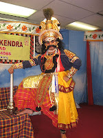
Major ethnic groups are the Tuluvas and konkanis.The main languages spoken in this area are Tulu and Konkani. The northern half is predominantly Konkani and the southern half is predominantly Tulu. The majority of the people follow Hinduism. Other religions practiced include Christanity and Islam. While the Tulu speakers are exclusively Hindus, Christians are almost exclusively Konkani speakers. This region has many sites of Hindu pilgrimage including Kollur, Dharmasthala, Udupi Srikrishna Math (Temple), Kateel, Murdeshwara, and Gokarna. The main occupation of the natives is farming and fishing. Fish is the staple diet of the people living in this region. Coconut is used generously in all the dishes. The region has abundant rainfall, recording average annual rainfall among the highest in India.

MY BLOG LIBRARY
For some of my articles visit:
http://mohanpaiblogger.blogspot.com/
http://mohanpaisarticles.blogspot.com/
http://biodiversity-mohanpai.blogspot.com/
For some key chapters from my book "The Western Ghats", please log on to:
http://westernghats-paimohan.blogspot.com/
For detailed blog (6 Chapters from my book) on Mahadayi/Mandovi River Valley, please log on to:
http://mohan-pai.blogspot.com/
For the book 'The Elderly' please log on to:
http://omashram.sulekha.com/blog/posts.htm
http://oldagecare-paimohan.blogspot.com/
You can also access my blogs on Sulekha and Wordpress
http://mohanpai.wordpress.com/
http://mohanpai.sulekha.com/blog/posts.htm
For my book "The Flight of Gods - Hindu Temples & Shrines of Goa" please log on to:
http://flightofgods.sulekha.com/blog/posts.htm
http://flightofgods.blogspot.com/
For “Miscellany” log on to:
http://paimohan-mohanpai.blogspot.com/
(Traditional Hindu Central Courtyard Houses of Goa)

Saturday, August 15, 2009

Tree of Life -Peepal (Ashwatha)

Sunday article of Mohan Pai

Peepal (Ashwatha)
-the Tree of Life
Ficus Religiosa
Black-hooded Oriole eating Peepal fig in Kolkatta
“Among trees, I am the Ashwatha”
- Bhagavad Gita
Flora in general play a central role in the Indian sacred culture. Two varieties of the fig (called Ashvatha in Sanskrit), the banyan tree and the peepal tree are the most revered in the Indian tradition, and both are considered the trees of life. The banyan symbolizes fertility according to the Agni Purana and is worshipped by those wanting children. It is also referred to as the tree of immortality in many Hindu scriptures.
Ashwatha: The Tree of Life
Called Ashvatha in Sanskrit, the Peepal (Ficus religiosa) is a very large tree. Its bark is light grey, smooth and peels in patches. Its heart-shaped leaves have long, tapering tips. The slightest breeze makes them rustle. The fruit is purple when ripe. The Peepal is the earliest-known depicted tree in India: a seal discovered at Mohenjodaro, one of the cities of the Indus Valley Civilisation (c. 3000 BC - 1700 BC), shows the Peepal being worshipped. During the Vedic period, its wood was used to make fire by friction.
Ashwatha is sacred to Hindus as well as Buddhists. Ashwatha literally means "Where horses stood" (ashwa + tha).Sage Shankaracharya interprets this tree as representing the the entire cosmos. 'Shwa' in Sanskrit means tomorrow. 'a' indicates negation, and 'tha' means one that stands or remains. He interprets Ashwatha to indicate "One which does not remain the same tomorrow", or the universe itself. Ashwatha tree is quite remarkable because it grows both upwards as well as top to bottom. The branches themselves morph into roots, so even if the original tree decays and perishes, its branches underneath are young and continue to enclose the parent. This eternal life of the the Peepal tree has inspired many Indian philosophers and Hindu thought. Besides harboring thousands of birds, insects, and providing shade to animals and humans, its foliage is very rich in protein and the bark of the tree is used in several native medicinal drugs. There was a time in India when a Peepal tree was planted in the premises of every temple, and was regarded as the Tree of Life.

The Brahma Purana and the Padma Purana, relate how once, when the demons defeated the gods, Vishnu hid in the peepal. Therefore spontaneous worship to Vishnu can be offered to a peepal without needing his image or temple. The Skanda Purana Peepal Tree also considers the peepal a symbol of Vishnu. He is believed to have been born under this tree. Some believe that the tree houses the Trimurti, the roots being Brahma, the trunk Vishnu and the leaves Shiva. The gods are said to hold their councils under this tree and so it is associated with spiritual understanding. The peepal is also closely linked to Krishna. In the Bhagavad Gita, he says: "Among trees, I am the ashvatha." Krishna is believed to have died under this tree, after which the present Kali Yuga is said to have begun. According to the Skanda Purana, if one does not have a son, the peepal should be regarded as one. As long as the tree lives, the family name will continue. To cut down a peepal is considered a sin equivalent to killing a Brahmin, one of the five deadly sins or Panchapataka. According to the Skanda Purana, a person goes to hell for doing so. Some people are particular to touch the Peepal only on a Saturday. The Brahma Purana explains why, saying that Ashvatha and Peepala were two demons who harassed people. Ashvatha would take the form of a peepal and Peepala the form of a Brahmin. The fake Brahmin would advise people to touch the tree, and as soon as they did, Ashvatha would kill them. Later they were both killed by Shani. Because of his influence, it is considered safe to touch the tree on Saturdays. Lakshmi is also believed to inhabit the tree on Saturdays. Therefore it is considered auspicious to worship it then. Women ask the tree to bless them with a son tying red thread or red cloth around its trunk or on its branches. On Amavasya, villagers perform a symbolic marriage between the neem and the peepal, which are usually grown near each other. Although this practice is not prescribed by any religious text, there are various beliefs on the significance of 'marrying' these trees. In one such belief, the fruit of the neem represents the Shivalinga and so, the male. The leaf of the peepal represents the yoni, the power of the female. The fruit of the neem is placed on a peepal leaf to depict the Shivalinga, which symbolises creation through sexual union, and so the two trees are 'married'. After the ceremony, villagers circle the trees to rid themselves of their sins.
In Buddhism
The Bodhi tree and the Sri Maha Bodhi propagated from it are famous specimens of Sacred Fig. The known planting date of the tree in Sri Lanka is 288 BC which gives it the oldest verified age for any angiosperm plant.This plant is considered sacred by the followers of Buddhism, and hence the name 'Sacred Fig' was given to it. Siddhartha Gautama is referred to have been sitting underneath a Bo-Tree when he was enlightened (Bodhi), or "awakened" (Buddha). Thus, the Bo-Tree is well-known symbol for happiness, prosperity, longevity and good luck.
According to the Buddha – 'He who worships the Peepal tree will receive the same reward as if he worshiped me in person'. The Peepal tree has its own symbolic meaning of enlightenment and peace.

Ram Bahadur Bamjom...the meditating boy under the peepal tree. This scene no doubt has become one of the widely photographed scene in recent times in Nepal. Posters have been circulated in Nepal and people are already wearing lockets with photos of Ram Bahadur Bamjom. Ram, famous as the Buddha Boy or the Little Buddha or the Meditating Boy stayed there meditating for about 10 months “without eating”.

The Bodhi Tree at the Mahabodhi Temple. Propagated from the Sri Maha Bodhi, which in turn is propagated from the original Bodhi Tree at this location.

References: Wikipedia, gurjari.net, kamat’s potpourri

MY BLOG LIBRARY
For some of my articles visit:http://mohanpaiblogger.blogspot.com/
http://mohanpaisarticles.blogspot.com/
http://biodiversity-mohanpai.blogspot.com/
For some key chapters from my book "The Western Ghats", please log on to:http://westernghats-paimohan.blogspot.com/
For detailed blog (6 Chapters from my book) on Mahadayi/Mandovi River Valley, please log on to:http://mohan-pai.blogspot.com/
For the book 'The Elderly' please log on to:
http://oldagecare-paimohan.blogspot.com/
http://omashram.sulekha.com/blog/posts.htm
You can also access my blogs on Sulekha and Wordpress:
http://mohanpai.sulekha.com
http://mohanpai.wordpress.com/

For my book "The Flight of Gods - Hindu Temples & Shrines of Goa" please log on to:
http://flightofgods.sulekha.com/blog/posts.htm
http://flightofgods.blogspot.com/

Saturday, August 8, 2009

Biodiversity - 'Extinction is forever'

Sunday article by Mohan Pai


Extinction is forever !

Over 99% of the species that ever lived are now extinct.

Mass extinction exhibits a cyclic nature. 5 major extinctions that occurred during the last 540 million years of earth history wiped out most living species.
Mass extinction is a sharp decrease in the number of species in a relatively short period of time. Mass extinctions affect most major taxonomic groups present at the time — birds, mammals, reptiles, amphibians, fish, invertebrates and other simpler life forms. They may be caused by one or both of:
*extinction of an unusually large number of species in a short period.
*a sharp drop in the rate of speciation.

Over 99% of species that ever lived are now extinct, but extinction occurs at an uneven rate. Based on the fossil record, the background rate of extinctions on Earth is about two to five taxonomic families of marine invertebrates and vertebrates every million years. Marine fossils are mostly used to measure extinction rates because they are more plentiful and cover a longer time span than fossils of land organisms. Since life began on earth, several major mass extinctions have significantly exceeded the background extinction rate. The most recent, the Cretaceous–Tertiary extinction event, occurred 65 million years ago, and has attracted more attention than all others as it marks the extinction of nearly all dinosaur species, which were the dominant animal class of the period. In the past 540 million years there have been five major events when over 50% of animal species died. There probably were mass extinctions in the Archean and Proterozoic Eons, but before the Phanerozoic there were no animals with hard body parts to leave a significant fossil record.


Estimates of the number of major mass extinctions in the last 540 million years range from as few as five to more than twenty. These differences stem from the threshold chosen for describing an extinction event as "major", and the data chosen to measure past diversity.

Extinction cycles
It has been suggested by several sources that biodiversity and/or extinction events may be influenced by cyclic processes. The best-known hypothesis of extinction events by a cyclic process is the 26M to 30M year cycle in extinctions proposed by Raup and Sepkoski (1986). More recently, Rohde and Muller (2005) have suggested that biodiversity fluctuates primarily on 62 ± 3 million year cycles.Much early work in this area also suffered from the poor accuracy of geological dating, where errors often exceed 10M years. However, improvements in radiometric dating have reduced the scale of uncertainty to at most 4M years - theoretically adequate for studying these processes.

The concept of periodicity has important implications for determining which factors cause extinction. Hypotheses invoking catastrophism have particularly been advanced utilizing this concept, which imply extra-terrestrial forces as extinction-causing agents. This is because only astronomical forces are known to operate on such a precise periotic time schedule. Contrary to catastrophism are hypotheses which focus on gradualism. These gradualistic hypotheses invoke various terrestrial extinction mechanisms including volcanism, glaciation, global climatic change, and changes in sea level. Most recently hypotheses centered on the new non-linear science of complexity have emerged. Under these hypotheses species-species interactions lead to occasional instability resulting in cascades which may ripple through entire ecosystems, with potentially devastating results.
Major extinction events
The classical "Big Five" mass extinctions: End Ordovician, Late Devonian, End Permian, End Triassic, and End Cretaceous. The Holocene extinction event is referred to as the Sixth Extinction.

Cretaceous-Tertiary. 65 million years ago, the dinosaurs were wiped out in a ma extinction that killed nearly a fifth of land vertebrate families, 16% of marine families and nearly half of all marine animals.
End of Triassic. About 200 million years ago, lava floods erupting from the central Atlantic are thought to have created lethal global warming, killing off more than a fifth of all marine families and half of marine genera.
Permian-Triassic. The worst mass extinction took place 250 million years ago, killing 95% of all species.
Late Devonian. About 360 million years ago, a fifth of marine families were wiped out, alongside more than half of all marine genera.
Ordovician-Silurian. About 440 million years ago, a quarter of all marine families were wiped out.
Most widely supported Causes
The most often cited as causes of mass extinctions are:
*Flood basalt events: 11 occurrences, all associated with significant extinctions.
*Sea-level falls: 12, of which 7 were associated with significant extinctions
*Asteroid impacts producing craters over 100km wide: one, associated with one mass extinction. *Asteroid impacts producing craters less than 100km wide: over 50, the great majority not associated with significant extinctions.

Evolutionary importance
Mass extinctions have sometimes accelerated the evolution of life on earth. When dominance of particular ecological niches passes from one group of organisms to another, it is rarely because the new dominant group is "superior" to the old and usually because an extinction event eliminates the old dominant group and makes way for the new one.For example mammaliformes ("almost mammals") and then mammals existed throughout the reign of the dinosaurs, but could not compete for the large terrestrial vertebrate niches which dinosaurs monopolized. The end-Cretaceous mass extinction removed the non-avian dinosaurs and made it possible for mammals to expand into the large terrestrial vertebrate niches. Many groups which survive mass extinctions do not recover in numbers or diversity, and many of these go into long-term decline.

Sixth Mass Extinction is NOW !
There is little doubt left in the minds of professional biologists that Earth is currently faced with a mounting loss of species that threatens to rival the five great mass extinctions of the geological past.
The classical "Big Five" mass extinctions are End Ordovician, Late Devonian, End Permian, End Triassic, and End Cretaceous. The Holocene extinction event is referred to as the Sixth Extinction, that is the extinction event that is taking place NOW !
A study published in the international journal Conservation Biology reveals a sorry and worsening picture of habitat destruction and species loss. It also describes the deficiencies of and opportunities for governmental action to lessen this mounting regional and global problem. The review highlights destruction and degradation of ecosystems as the main threat.
According to the IUCN Red List of Threatened Species, 2008
*Nearly 17,000 of the world's 45,000 assessed species are threatened with extinction (38 percent). Of these, 3,246 are in the highest category of threat, Critically Endangered, 4,770 are Endangered and 8,912 are Vulnerable to extinction.
*Nearly 5,500 animal species are known to be threatened with extinction and at least 1,141 of the 5,487 known mammal species are threatened worldwide.
*In 2008, nearly 450 mammals were listed as Endangered, including the Tasmanian Devil (Sarcophilus harrisii), after the global population declined by more than 60 percent in the last 10 years.
*Scientists have catalogued relatively little about the rest of the world's fauna: only 5 percent of fish, 6 percent of reptiles, and 7 percent of amphibians have been evaluated. Of those studied, at least 750 fish species, 290 reptiles, and 150 amphibians are at risk.
*The average extinction rate is now some 1,000 to 10,000 times faster than the rate that prevailed over the past 60 million years.
The Passenger Pigeon
In Michigan during a single hunt in 1878 an estimated 1,000 million birds were destroyed at nesting sites. On September 1, 1914 the last Passenger Pigeon named Martha died in captivity in the Cincinnati Zoo.


Indian Vultures
In India, the White backed vulture population was estimated at 30 million birds in 1992. Today, it is a mere 11,000 birds and falling due to Diclofenac poisoning.

Extinction is irreversible.
This has been part of the evolutionary process which has produced more advanced forms of life - a process that has occurred over a vast span of time over millions of years. The greatest contribution of Charles Darwin, who propounded the Theory of Evolution, in his logical explanation for evolutionary changes and appearance of new form of life - natural selection - the success of those organisms that are capable of adapting to the environment, to survive and reproduce. One of the world’s rarest birds and an almost extinct species, today lessthan 200 birds survive!
In India, the Cheetah, the lesser one-horned rhinoceros, the pink- headed duck and the mountain quail have become extinct in the last one century.
The Sangai, the brow-antlered deer is found only in Manipur and only 162 animals survive.
Many mammals and birds have become rare and endangered and many a natural range diminished in size with increasing deforestation, often confining the animals to small territories.

The Golden Toad of Monteverde, Costa Rica was among the first casualties of amphibian decline. Formerly abundant, it was last seen in 1989.

References: Wikipedia, J. C. Daniel (’Extinction is for ever’), IUCN Red List, park.org, Mohan Pai.
MY BLOG LIBRARY
For some of my articles visit:
http://biodiversity-mohanpai.blogspot.com/
For some key chapters from my book "The Western Ghats", please log on to:http://westernghats-paimohan.blogspot.com/
For detailed blog (6 Chapters from my book) on Mahadayi/Mandovi River Valley, please log on to:http://mohan-pai.blogspot.com/
For the book 'The Elderly' please log on to:

Saturday, July 4, 2009

Biodiversity - Noah's Ark

69. Biodiversity - Noah’s Ark - An article by Mohan Pai - July, 2009


Noah's Ark

or Manu & the Fish


"With more and more species threatened with extinction by the flood that is today’s global economy, we may be the first generation in human history that literally has to act like Noah - to save the last pair of a wide range of species. Or as God commanded Noah in Genesis “ And every living thing of all flesh, you shall bring two of every sort into the ark, to keep them alive with you; they shall be male and female” - Thomas L. Friedman

Native global flood stories are documented as history or legend in almost every region on earth. Old world missionaries reported their amazement at finding remote tribes already possessing legends with tremendous similarities to the Bible's accounts of the worldwide flood. H.S. Bellamy in Moons, Myths and Men estimates that altogether there are over 500 Flood legends worldwide. Ancient civilizations such as (China, Babylonia, Wales, Russia, India, America, Hawaii, Scandinavia, Sumatra, Peru, and Polynesia) all have their own versions of a giant flood.These flood tales are frequently linked by common elements that parallel the Biblical account including the warning of the coming flood, the construction of a boat in advance, the storage of animals, the inclusion of family, and the release of birds to determine if the water level had subsided. The overwhelming consistency among flood legends found in distant parts of the globe indicates they were derived from the same origin, but oral transcription has changed the details through time.

Perhaps the second most important historical account of a global flood can be found in a Babylonian flood story in the Epic of Gilgamesh. When the Biblical and Babylonian accounts are compared, a number of outstanding similarities are found that leave no doubt these stories are rooted in the same event or oral tradition.

Matsya Avatar

Manu - the Indian myth

The Matsya Avatara of Lord Vishnu is said to have appeared to King Manu (whose original name was Satyavrata), the then King of Dravida, while he washed his hands in a river. This river was supposed to have been flowing down the Malaya Mountains in his land of Dravida. According to the Matsya Purana, his ship is supposed to have been perched after the deluge on the top of this Malaya Mountains. (This land or kingdom of Dravida that was ruled over by Satyavrata or Manu might have been an original, greater Dravida, that might have stretched from Madagascar and East Africa in the west to Southernmost India and further to Southeast Asia and Australia in the east.) The little fish asked the king to save It, upon his doing so, kept growing bigger and bigger. It also informed the King of a huge flood which would occur soon. The King builds a huge boat, which houses his family, 9 types of seeds, and animals to repopulate the earth after the deluge occurs and the oceans and seas recede.This story is to an extent similar to other deluge stories, like those of Gilgamesh from ancient Sumerian Mythology, and the story of Noah's ark from Judeo-Christianity.

With the human population expected to reach 9-10 billion by the end of the century and the planet in the middle of its sixth mass extinction this time due to human activity the next few years are critical in conserving Earth’s precious biodiversity. It is our generation and our civilization that is responsible for causing the flood of commercial development which is causing Global Warming and pollution that could wipe out much of the world’s biodiversity.

To quote E. O. Wilson “Except from giant meteorite strikes or other catastrophes every 100 million years or so, Earth has never experienced anything like the contemporary human juggernaut. With the global species extinction rate now exceeding the global species birthrate at least a hundredfold, and soon to increase ten times that much, and with the birthrate falling through the loss of sites where evolution can occur; the number of species is plummeting. The original level of biodiversity is not likely to be regained in any period of time that has meaning for the human mind.”Since Man is causing this flood, it also now becomes his responsibility to build the Ark that is needed to preserve life on the earth.

Let us consider the following facts:

During the past 150 years, humans have directly impacted and altered close to 47% of the global land area.

Under one bleak scenario, biodiversity will be threatened on almost 72% of Earth’s land area by 2032.

48% of South East Asia, the Congo Basin, and parts of the Amazon will likely be converted to agricultural land, plantations and urban areas — compared with 22% today, suggesting wide depletions of biodiversity.

Starting some 45,000 years ago a high proportion of larger land animals became extinct in North America, Australia, the Caribbean, and elsewhere, coinciding with human arrival.


The current textbook definition of "biodiversity" is "variation of life at all levels of biological organization".

Biodiversity can be defined as the totality of life on earth. It's a vast field, encompassing all the world's ecosystems, all the plant and animal species that populate those ecosystems, and all the genes that make up the hereditary material of each living species. To get some inkling of the vastness of the topic I am reproducing below E. O. Wilson’s speech given at the Explorer’s Club on March 18, 2006:

What is left to explore?

Why, the biosphere of course, that razor-thin membrane of life plastered to the surface of Earth so thin it can’t be seen edgewise from an orbiting space vehicle yet still the most complex entity by far we know in the universe. How well do we understand this part of the world? Proportionately not very much. We live on a little-known planet. Let me give you some examples. The best-studied animals are the birds, which have been carefully collected by naturalists and explorers for centuries. Nevertheless, an average of 3 new species are added each year to the 10,000 already described by scientists. Comparable to them are the flowering plants: about 280,000 species known out of 320,000 or more estimated to exist. From there it goes steeply downhill. You’d think that the amphibians—that is, frogs, salamanders, and caecilians—would be comparable to the birds, but in fact they are still poorly explored: from 1985 to 2001, 1,530 new species were added to the 5,300 already found, an increase of over one-fourth, and with more new species pouring in.

When we next move to the invertebrates, what I like to call the little things that run the world, we get a fuller glimpse of the depth of our ignorance. Consider nematode worms, the almost microscopic wriggling creatures that teem as free-living forms and parasites everywhere, on the land and in the sea. They are the most abundant animals on Earth. Four out of every five animals on Earth is a nematode worm. If you were to make all of the solid matter on the surface of Earth invisible except for the nematode worms, you still could see its outline in nematode worms. About 16,000 species are known to science; the number estimated actually to exist by specialists is over 1.5 million. Almost certainly the world’s ecosystems and our own lives depend on these little creatures, but we know absolutely nothing about the vast majority. To continue: about 900,000 kinds of insects are known to science (I’ve just finished describing 340 new species of ants myself, for example) but the true global number could easily exceed 5 million. How many kinds of plants, animals, and microorganisms make up the biosphere? Somewhere between 1.5 and 1.8 million species have been discovered and given a Latinized scientific name. How many species actually exist? It is an amazing fact that we do not know to the nearest order of magnitude how many exist. It could be as low as 10 million or as high as 100 million or more.

Those of us in biodiversity studies say that we have knowledge of only about 10 percent of the kinds of organisms on Earth. The nematodes and insects and invertebrates all shrink in diversity before the bacteria and archaea, the dark matter of planet Earth. Roughly 6,000 species of bacteria are known. That many can be found in the 10 billion bacterial cells in a single gram, a handful, of soil—virtually all still unknown to science. It’s been recently estimated that a ton of fertile soil supports 4 million species of bacteria. We believe each one is exquisitely adapted to a particular niche, as a result of long periods of evolution. We don’t know what those niches are. What we do know is that we depend on those organisms for our existence. A search is on right now at least for the bacteria that live in the human mouth. The number of species adapted to that environment so far is 700. These bacteria are friendly; they appear to function as symbionts that keep disease-causing bacteria from invading. For those species your mouth is a continent. They dwell on the mountain ridges of a tooth; they travel long distances into the deep valleys of your gums; they wash back and forth in the ocean tides of your saliva. I’m not suggesting that we give an Explorer’s Club flag to a dentist. But you get the point. Every part of the world, including Central Park where a new kind of centipede was recently found, has new kinds of life awaiting discovery.

But—if none of this impresses you, would you like an entire new living planet for your delectation? The closest we may ever come is the world of the SLIMES (that’s an acronym for Subterranean Lithoautotrophic Microbial Ecosystems), a vast array of bacteria and microscopic fungi teeming below Earth’s surface to depths of up to 2 miles or more, completely independent of life on the surface, living on energy from inorganic materials, possibly forming a greater mass than all of life on the surface. The SLIMES would likely go on existing if we were to burn everything on the surface to a crisp. In approaching biodiversity, we are all explorers, scientists and all others who care about the natural world, now put in perspective, like Cortez and his men on a peak in Darien, before the new ocean, staring, in Keat’s expression, in wild surmise at the unknown world stretching before us.

E. O. Wilson's Explorers Club Speech 18th March, 2006


Coral Reef

The highest percentage per unit of area of endangered species are in the tropical rainforests and coral reefs. These species are now disappearing at the rate somewhere a thousand times faster than they are born due to human activity. At this rate, in one human lifetime, half these species of the world which have developed over thousands or millions of years, could be eliminated. Conservation needs to be focussed on the hot spots of biodiversity and fresh water systems of the world. Fresh water systems deserve special attention because they are under heaviest assault from pollution and drainage.

Most of the species extinctions from 1000 AD to 2000 AD are due to human activities, in particular destruction of plant and animal habitats. Raised rates of extinction are being driven by human consumption of organic resources, especially related to tropical forest destruction. While most of the species that are becoming extinct are not food species, their biomass is converted into human food when their habitat is transformed into pasture, cropland, and orchards. It is estimated that more than a third of the Earth's biomass is tied up in only the few species that represent humans, livestock and crops. Because an ecosystem decreases in stability as its species are made extinct, these studies warn that the global ecosystem is destined for collapse if it is further reduced in complexity. Factors contributing to loss of biodiversity are: overpopulation, deforestation, pollution (air pollution, water pollution, soil contamination) and global warming or climate change, driven by human activity. These factors, while all stemming from overpopulation, produce a cumulative impact upon biodiversity.

“The science of living beings in general, and especially of the human individual, has not made such a great progress. It still remains in the descriptive state. Man is an indivisible whole of extreme complexity. No simple representation of him can be obtained. There is no method of comprehending simultaneously in his entirety, his parts and his relations with the outer world.”
“We are beginning to realise the weakness of our civilisation. Many want to shake off the dogmas imposed upon them by modern society - those who are bold enough to understand the necessity, not only mental, political and social changes, but the overthrow of industrial civilisation and of the advent of another conception of human progress’’

- Man, the Unknown - Dr. Alexis Carrel.


References: ‘Hot, Flat, and Crowded’ by Thomas L. Friedman, E. O. Wilson’s work, ‘Man the Unknown’ by Dr. Alexis Carrel, Wikipedia.


MY BLOG LIBRARY

For some of my articles visit:

http://mohanpaiblogger.blogspot.com/

http://mohanpaisarticles.blogspot.com/

http://biodiversity-mohanpai.blogspot.com/
For some key chapters from my book "The Western Ghats", please log on to:http://westernghats-paimohan.blogspot.com/

For detailed blog (6 Chapters from my book) on Mahadayi/Mandovi River Valley, please log on to:http://mohan-pai.blogspot.com/

For the book 'The Elderly' please log on to:http://oldagecare-paimohan.blogspot.com/
http://omashram.sulekha.com/blog/posts.htm
You can also access my blogs on Sulekha and Wordpress:
http://mohanpai.sulekha.com
http://mohanpai.wordpress.com/
For my book "The Flight of Gods - Hindu Temples & Shrines of Goa" please log on to:
http://flightofgods.sulekha.com/blog/posts.htm
http://flightofgods.blogspot.com/

Saturday, June 27, 2009

Indian Rainforests

An article by Mohan Pai


The Indian Rainforests


Rainforests - the Lungs of the Planet Earth

Tropical rainforests are vital to the global ecosystem and human existence. They are a world like no other and are unparalleled in terms of their biological diversity. Tropical rainforests are a natural reservoir of genetic diversity which offers a rich source of medicinal plants, high-yield foods, and a myriad of other useful forest products. They are an important habitat for migratory animals and sustain as much as 50 percent of the species on Earth, as well as a number of diverse and unique indigenous cultures. Tropical rainforests play an elemental role in regulating global weather in addition to maintaining regular rainfall, while buffering against floods, droughts, and erosion. They store vast quantities of carbon, while producing a significant amount of the world's oxygen. Rainforests once covered 14% of the earths surface and even though they now only cover 6% of the earth, they are home to almost half of the worlds population of mammals, amphibians, reptiles, insects, bird life and plant life.

Tropical rainforests are located in a band around the equator (Zero degrees latitude) in the area between the Tropic of Cancer (23.5° North latitude) and the Tropic of Capricorn (23.5° South latitude).This 3,000 mile (4800 kilometres) wide band is known as the 'tropics'.

The equator is a line that circles the centre of our global world and is situated halfway between the north and south poles. Temperatures at the equator are high. These high temperatures cause accelerated evaporation of water, which results in frequent rain in rainforests in the tropics.


World Rainforests
Tropical rainforests are found between latitudes 10° N and 10° S. This includes the Amazon Basin of South America, the Zaire Basin of Africa and the islands and peninsulas of South-east Asia.In Southeast Asia, the tropical rainforests are found in India, Bangladesh, Sri Lanka, Malaysia, Brunei, Indonesia, Burma and Papua New Guinea. The rainforests found in India, Bangladesh and Sri Lanka are in small patches and strips, while on the other hand, Indonesia contains one-tenth of the world’s rainforest and 40% of all Asian rainforests! However sadly, as Indonesia is progressing further into modernisation, it is losing its rainforests to commercial logging and human settlements. Malaysia too has lost about two third of its lowland forest to plantations. On a brighter side, Papua New Guinea still has areas of rainforest yet to be disturbed, due to its mountainous terrain. Papua New Guinea is home to many amazing animals, one being the largest butterfly in the world; the Queen Alexandra’s birdwing. Its wing span can reach up to 10 inches wide!

Although they cover less than 2 percent of Earth's surface, they house an estimated 50 percent of all life on the planet. The immense numbers of creatures that inhabit the tropical rainforests are so great—an estimated 50 million species— they are almost incomprehensible. The sheer range of numbers alone suggests the limited extent of our knowledge of these forests. For example, whereas temperate forests are often dominated by a half dozen tree species or fewer that make up 90 percent of the trees in the forest, a tropical rainforest may have more than 480 tree species in a single hectare (2.5 acres). A single bush in the Amazon may have more species of ants than the entire British Isles. This diversity of rainforests is not a haphazard event, but is the result of a series of unique circumstances.

Layers

A tropical rainforest is typically divided into four main layers, each with different plants and animals adapted for life in that particular area: the emergent, canopy, understory, and forest floor layers.
Emergent layer
The emergent layer contains a small number of very large trees called emergents, which grow above the general canopy, reaching heights of 45-55 m, although on occasion a few species will grow to 70-80 m tall. They need to be able to withstand the hot temperatures and strong winds in some areas. Eagles, butterflies, bats, and certain monkeys inhabit this layer.

Diagram: Coutesy Animal Corner
Canopy layer
The canopy layer contains the majority of the largest trees, typically 30-45 m tall. The densest areas of biodiversity are found in the forest canopy, a more or less continuous cover of foliage formed by adjacent treetops. The canopy, by some estimates, is home to 50 percent of all plant species, suggesting that perhaps half of all life on Earth could be found there. Epiphytic plants attach to trunks and branches, and obtain water and minerals from rain and debris that collects on the supporting plants. The fauna is similar to that found in the emergent layer, but more diverse. A quarter of all insect species are believed to exist in the rainforest canopy. Scientists have long suspected the richness of the canopy as a habitat, but have only recently developed practical methods of exploring it. As long ago as 1917, naturalist William Beebe declared that "another continent of life remains to be discovered, not upon the Earth, but one to two hundred feet above it, extending over thousands of square miles." True exploration of this habitat only began in the 1980s, when scientists developed methods to reach the canopy, such as firing ropes into the trees using crossbows. Exploration of the canopy is still in its infancy, but other methods include the use of balloons and airships to float above the highest branches and the building of cranes and walkways planted on the forest floor. The science of accessing tropical forest canopy using airships, or similar aerial platforms, is called dendronautics.
Understory layer
The understory layer lies between the canopy and the forest floor. The understory (or understorey) is home to a number of birds, snakes, and lizards, as well as predators such as jaguars, boa constrictors, and leopards. The leaves are much larger at this level. Insect life is also abundant. Many seedlings that will grow to the canopy level are present in the understory. Only about 5 percent of the sunlight shining on the rainforest reaches the understory. This layer can also be called a shrub layer, although the shrub layer may also be considered a separate layer.
Forest floor
The forest floor, the bottom-most layer, receives only 2 percent of sunlight. Only plants adapted to low light can grow in this region. Away from riverbanks, swamps, and clearings
where dense undergrowth is found, the forest floor is relatively clear of vegetation because of the low sunlight penetration. It also contains decaying plant and animal matter, which disappears quickly due to the warm, humid conditions promoting rapid decay. Many forms of fungi grow here which help decay the animal and plant waste. It takes up to 20 minutes for rain to actually touch the ground from the trees. Forest floor - Mahadayi Valley, Karnataka.
Because of the ample solar energy, tropical rainforests are usually warm year round with temperatures from about 72-93F (22-34C), although forests at higher elevations, especially cloud forests, may be significantly cooler. The temperature may fluctuate during the year, but in some equatorial forests the average may vary as little as 0.5F (0.3C) throughout the year. Temperatures are generally moderated by cloud cover and high humidity.

PRECIPITATION
An important characteristic of rainforests is apparent in their name. Rainforests lie in the intertropical convergence zone where intense solar energy produces a convection zone of rising air that loses its moisture through frequent rainstorms. Rainforests are subject to heavy rainfall, at least 80 inches (2,000 mm), and in some areas over 430 inches (10,920 mm) of rain each year. In equatorial regions, rainfall may be year round without apparent "wet" or "dry" seasons, although many forests do have seasonal rains. Even in seasonal forests, the period between rains is usually not long enough for the leaf litter to dry out completely. During the parts of the year when less rain falls, the constant cloud cover is enough to keep the air moist and prevent plants from drying out. Some neotropical rainforests rarely go a month during the year without at least 6" of rain. The stable climate, with evenly spread rainfall and warmth, allows most rainforest trees to be evergreen—keeping their leaves all year and never dropping all their leaves in any one season. Forests further from the equator, like those of India, Thailand, Sri Lanka, and Central America, where rainy seasons are more pronounced, can only be considered "semi-evergreen" since some species of trees may shed all of their leaves at the beginning of the dry season. Annual rainfall is spread evenly enough to allow heavy growth of broad-leafed evergreen trees, or at least semi-evergreen trees. The moisture of the rainforest from rainfall, constant cloud cover, and transpiration (water loss through leaves), creates intense local humidity. Each canopy tree transpires some 200 gallons (760 liters) of water annually, translating to roughly 20,000 gallons (76,000 L) of water transpired into the atmosphere for every acre of canopy trees. Large rainforests (and their humidity) contribute to the formation of rain clouds, and generate as much as 75 percent of their own rain.
The Amazon rainforest is responsible for creating as much as 50 percent of its own precipitation. Deforestation and climate change may be affecting the water cycle in tropical rainforests. Since the mid-1990s, rainforests around the world have experienced periods of severe drought, including southeast Asia in 1997 and 2005 and the Amazon in 2005. Dry conditions, combined with degradation from logging and agricultural conversion, make forests more vulnerable to wildfire.
Rainforests Waters
Tropical rainforests have some of the largest rivers in the world, like the Amazon, Madeira, Mekong, Brahmaputra, Negro, Orinoco, and Zaire (Congo), because of the tremendous amount of precipitation their watersheds receive. These mega-rivers are fed by countless smaller tributaries, streams, and creeks. For example, the Amazon alone has some 1,100 tributaries, 17 of which are over 1,000 miles long. Although large tropical rivers are fairly uniform in appearance and water composition, their tributaries vary greatly. Many tropical rivers and streams have extreme high and low water levels that occur at different parts of the year. In addition to rivers, rainforests have conventional, free-standing lakes and so-called oxbow lakes, formed when a river changes course. These lakes are home to species adapted to the quiet, stagnant conditions. Tropical waters, whether they be giant rivers, streams, or oxbow lakes, are almost as rich in animal species as the rainforests that surround them. But they, too, are increasingly threatened by human activities, including pollution, siltation resulting from deforestation, hydroelectric projects, and over-harvesting of resident species.
Forest - the mother of rivers
There is an umbilical connection between healthy forests and water regimes. Forests are nurseries and cisterns for our life giving rivers. Forest areas give birth to all the major and minor rivers. Most of the rivers spring from some unknown forests. Because of the slope the rain water cannot stay to soak into the earth, it flows downhill rapidly taking some of the earth with it This run-off on the hillsides will only be halted, and water will percolate into the earth where there is a good tree cover. In fact a forest “traps” rainwater and channels it into underground streams.

World’s Largest Pharmacy

Medicinal plants and herbs which are in great demand by Pharmaceutical MNCs e.g. Mappia foetida used for the treatment of ovarian colon cancers. The tree is the richest source of Camptothetician (CPT) used in the treatment of these cancers.

Tropical rainforests are called "the world's largest pharmacy" because of the large amount of natural medicines discovered in rainforests that are derived from rainforest plants. For example, rain forests contain the basic ingredients of hormonal contraception methods, cocaine, stimulants, and tranquilizing drugs. Curare (a paralyzing drug) and quinine (a malaria cure) are also found there.

CONSEQUENCES OF DEFORESTATION
Rainforests around the world still continue to fall. Does it really make a difference? Why should anyone care if some plants, animals, mushrooms, and microorganisms perish? Rainforests are often hot and humid, difficult to reach, insect-ridden, and have elusive wildlife.

Actually the concern should not be about losing a few plants and animals; mankind stands to lose much more. By destroying the tropical forests, we risk our own quality of life, gamble with the stability of climate and local weather, threaten the existence of other species, and undermine the valuable services provided by biological diversity. While in most areas environmental degradation has yet to reach a crisis level where entire systems are collapsing, it is important to examine some of the effects of existing environmental impoverishment and to forecast some of the potential repercussions of forest loss. Continuing loss of natural systems could make human activities increasingly vulnerable to ecological surprises in the future. The most immediate impact of deforestation occurs at the local level with the loss of ecological services provided by tropical rainforests and related ecosystems. Such habitats afford humans valuable services such as erosion prevention, flood control, water treatment, fisheries protection, and pollination—functions that are particularly important to the world's poorest people, who rely on natural resources for their everyday survival. Forest loss also reduces the availability of renewable resources like timber, medicinal plants, nuts and fruit, and game. Over the longer term, deforestation of tropical rainforests can have a broader impact, affecting global climate and biodiversity. These changes are more difficult to observe and forecast from local effects, since they take place over a longer time scale and can be difficult to measure.

Deforestation and the Global Carbon Cycle
Carbon dioxide ( CO2) is the major gas involved in the greenhouse effect, which causes global warming. All the things that produce CO2 (like car burning gas) and the things that consume Co2 (growing plants) are involved in the “global carbon cycle”. Tropical forests hold an immense amount of carbon, which joins with oxygen to form CO2. The plants and soil of tropical forests hold 460-575 billion metric tons of carbon worldwide. Each acre of tropical forest stores about 180 metric tons of carbon.
Deforestation increases the amount of CO2 and other trace gases in the atmosphere. When a forest is cut and replaced by cropland and pastures, the carbon that was stored in the tree trunks (wood is about 50% carbon) joins with oxygen and is released into the atmosphere as Co2.The loss of forests has a great effect on the global carbon cycle. From 1850 to 1990, deforestation worldwide (including that in the United States) released 122 billion metric tons of carbon into the atmosphere, with the current rate being 1.6 billion metric tons per year. In comparison all the fossil fuels (coal, oil and gas) burned during a year release about 6 billion tons per year.Releasing CO2 into the atmosphere increases the greenhouse effect, and may raise global temperature. The role of fossil fuels burned by cars and industry is well known, but tropical deforestation releases about 25% of the amount released by fossil fuel burning. Tropical deforestation, therefore, contributes a significant part of the increasing CO2 in the atmosphere.
Today tropical rainforests are disappearing from the face of the globe. Despite growing international concern, rainforests continue to be destroyed at a pace exceeding 80,000 acres (32,000 hectares) per day. World rainforest cover now stands at around 2.5 million square miles (6 million square kilometers), an area about the size of the contiguous 48 United States or Australia and representing around 5 percent of the world's land surface. Much of this remaining area has been impacted by human activities and no longer retains its full original biodiversity.


The Rainforests of India

The rainforests in India are the centres of species richness and endemism and due to this has the status of being one of the 12 mega-biodiversity countries in the world. Even the two hotspots in India, the Western Ghats and the Eastern Himalayas, owe their status due to the presence of rainforests therein. These forests form very important catchments areas for major river systems, maintain soil and water fertility not only in the immediate vicinity but also hundreds of kilometers away, harbours rich indigenous culture with long traditions of sustainable use of traditional knowledge systems especially on medicines and wild relatives of cultivate crops. It is to these rainforests that more than 80% of the endemic flora and fauna of India are confined. Being the most complex ecosystem, the rain forests are living laboratories in which complex ecological, biological and evolutionary processes that have shaped the Earth.

Bamboo brakes, Muthodi, Karnataka
Tropical forest cover in India has been reduced to two major areas: the coastal hills of the Western Ghats (about 55,000 square miles or 135,000 sq. km) and 14,000 square miles (34,500 sq. km) in Northeastern India. Very little of India's forest cover is considered pristine. 22.8% —or about 67,701,000 hectares—of India is forested. Change in Forest Cover: Between 1990 and 2000, India gained an average of 361,500 hectares of forest per year. The amounts to an average annual reforestation rate of 0.57%. Between 2000 and 2005, the rate of forest change decreased by 92.3% to 0.04% per annum. In total, between 1990 and 2005, India gained 5.9% of its forest cover, or around 3,762,000 hectares. Measuring the total rate of habitat conversion (defined as change in forest area plus change in woodland area minus net plantation expansion) for the 1990-2005 interval, India gained 1.0% of its forest and woodland habitat.Biodiversity and Protected Areas: India has some 2356 known species of amphibians, birds, mammals and reptiles according to figures from the World Conservation Monitoring Centre. Of these, 18.4% are endemic, meaning they exist in no other country, and 10.8% are threatened. India is home to at least 18664 species of vascular plants, of which 26.8% are endemic. 4.9% of India is protected under IUCN categories I-V.
The Rainforests of the Western Ghats

The Western Ghats hill range in India contains spectacular landscapes and an incredible array of wild species, many found nowhere else in the world. One among the world’s 34 most biologically diverse “hotspots”, the region has representation of a wide variety of natural ecosystems from grasslands and dry forests to rainforests, rivers, and streams, threatened by a multitude of human activities such as industrialisation, agriculture, grazing, hunting, deforestation, fragmentation, and degradation. Today, rainforests in the Western Ghats occur largely as fragments within a landscape matrix dominated by commercial plantations of tea, coffee, and other cash crops. With an annual deforestation rate of 1.2%, the southern Western Ghats is losing about 500 square kilometres of forest every year. NCF’s programme focuses on human impacts on wild species and habitats, biological surveys, human-wildlife conflict research and mitigation, and restoration to turn the tide of destruction towards conservation.

Forests of the western slopes of the Western Ghats, Konkan
The northern portion of the range is generally drier than the southern portion, and at lower elevations makes up the North Western Ghats moist deciduous forests ecoregion, with mostly deciduous forests made up predominantly of teak. Above 1,000 meters elevation are the cooler and wetter North Western Ghats montane rain forests, whose evergreen forests are characterized by trees of family Lauraceae.The evergreen Wayanad forests of Kerala mark the transition zone between the northern and southern ecoregions of the Western Ghats. The southern ecoregions are generally wetter and more species-rich. At lower elevations are the South Western Ghats moist deciduous forests, with Cullenia the characteristic tree genus, accompanied by teak, dipterocarps, and other trees. The moist forests transition to the drier South Deccan Plateau dry deciduous forests, which lie in its rain shadow to the east.

Clear felling, Mahadayi Valley, Karnataka
Above 1,000 meters are the South Western Ghats montane rain forests, also cooler and wetter than the surrounding lowland forests, and dominated by evergreen trees, although some montane grasslands and stunted forests can be found at the highest elevations. The South Western Ghats montane rain forests are the most species-rich ecoregion in peninsular India; eighty percent of the flowering plant species of the entire Western Ghats range are found in this ecoregion.
Tropical Montane - Bedthi River Valley, Karnataka
The animal life of the Indian peninsular region is characterised by the absence of many of the Indo-Malay species which are so abundant in the hill forests of the Himalayas. It is the home of the true Indian fauna of which the spotted deer, the nilgai, the blackbuck, the four-horned antelope, and the sloth bear are typical representatives. They are found no where else. Other species like the gaur, the sambar and the muntjac (barking deer) occur both in India and Malay countries. The Western Ghats, in sharp contrast to the adjoining dry zone of the Deccan present a region of great humidity and heavy rainfall. The forests covering the western slopes are at times very dense and composed of lofty trees, festooned with perennial creepers. Bamboos form a luxuriant undergrowth. In parts of the range the forests are more open and the banks of clear streams running through them are covered with spice and betel groves.
The Nilgiris, an offshoot of the Western Ghats, rise precipitously to form extensive grassy downs and tablelands seamed with densely forested gorges or Sholas. They are composed of evergreen trees with dense undergrowth.


1. Malabar Giant Squirrel 2. Lion tailed Macaque
Among the species limited to these forests are the Nilgiri langur, the Lion-tailed macaque, the Nilgiri brown mongoose and the striped necked mongoose, the Malabar civet, and the spiny mouse. In the higher levels of the Nilgiris and the Anaimalais are found such characteristically Himalayan animals as the tahr, the pine marten and the European otter.
Endemic species of the Western Ghats
One hundred and twenty species of mammals are known from the Western Ghats of which fourteen species are endemic (found only in that area).
Nilgiri Tahr
The mammalian fauna of the Western Ghats is dominated by insectivores (11 species), bats (41 species) and rodents (27 species including porcupine). Few studies have, however, paid attention to the community structure and organisation of these small mammals in the Western Ghats, although there have been attempts to review our understanding of the status and ecology of smaller cats and lesser carnivores.

The Rainforests of the Northeast India

The Northeast India lying between 22-30 degree N latitude and 89-97 degree E longitude, and sprawling over 2,62,379 sq.km., Northeast India represents the transition zone between the Indian, Indo-Malayan and Indo-Chinese biogeographic regions and a meeting place of the Himalayan Mountains and Peninsular India. It was the part of the northward migrating ‘Deccan Peninsula’ that first touched the Asian landmass after the break up of Gondwanaland in the early Tertiary Period. Northeast India is thus the geographical ‘gateway’ for much of India’s flora and fauna, and as a consequence, the region is one of the richest in biological values. It is in this lowland-highland transition zone that the highest diversity of biomes or ecological communities can be found, and species diversities within these communities are also extremely high.
Northeast India is blessed with a wide range of physiography and ecoclimatic conditions. The State of Assam has extensive flood plains, while Khangchendzonga in Sikkim stands 8586 m. tall. Cherrapunjee in the State of Meghalaya holds the record for the highest rainfall in a single month (9,300 mm) as well as the most in a year (26,461 mm) in India, while the nearby Mawsynram has the world’s highest average rainfall (11,873 mm). The forests in the region are extremely diverse in structure and composition and combine tropical and temperate forest types, alpine meadows and cold deserts. There are regions, for example, in the State of Sikkim, where the faunal assemblages also change rapidly from tropical to subtropical, temperate, alpine and finally to cold desert forms.

After the Andaman and Nicobar Islands and the Western Ghats, Northeast India forms the main region of tropical forests in India, especially the species-rich tropical rain forests. The tropical semi-evergreen and moist deciduous forests in the lowlands of this region extend south and west into the subcontinent, and east into Southern China and Southeast Asia. The subtropical forests of the region follow the foothills of the Himalaya to the west; also extend into Southeast China in the east. Himalayan temperate and subalpine zone forests extend from northern Pakistan and adjacent Afghanistan through Northeast India to Southwest China. Each of the eight States of the region, namely Arunachal Pradesh, Assam, Meghalaya, Manipur, Mizoram, Nagaland, Sikkim and Tripura, boast of several endemics in flora as well as fauna. This region represents an important part of the Indo-Myanmar biodiversity hotspot.


1. Dooars forests, North Bengal 2. Golden Langur
The primary vegetation in extensive areas of the Northeast India has been disturbed and modified and in some places destroyed by seismic activities, frequent landslides and resultant soil erosion. While these natural causes have contributed only marginally to the change in vegetation type, it is the activity of Man that has led to the irreversible transformation in the landscapes and has resulted in colossal loss of biodiversity in the entire region. Human influences have pushed many species to the brink of extinction and have caused havoc to natural fragile ecosystems. Such devastations to natural ecosystems are witnessed almost everywhere in the region and is a cause of great concern.

1. Slow Loris 2. Reticulated Python

Northeast India has 64% of the total geographical area under forest cover and it is often quoted that it continues to be a forest surplus region. However, the forest cover is rapidly disappearing from the entire region. There has been a decrease of about 1800 sq.km. in the forest cover between 1991 and 1999. More worrisome still is the fact that the quality of the forest is also deteriorating, with the dense forests (canopy closure of 40% or more) becoming degraded into open forest or scrub. Though there is a succession of several edaphic formations, a vast area of land has already been transformed into barren and unproductive wastelands. This being the case, the statistics of ‘more than 64 % of the total geographic area in this region under forest cover’ could be misleading. For example, though the forest cover in Manipur extends to 78% of the total geographic area, only 22% of forest area is under dense forest cover and the rest has been converted to open forests.

Except in the Brahmaputra and Barak valleys of Assam where substantial areas are under agriculture, little of the land is available for settled cultivation. Hence, shifting agriculture or slash-and-burn agriculture is the major land use in Northeast India and extends over 1.73 million ha. Different agencies have come up with different figures concerning the total area under shifting cultivation (jhum) in the region. What is not disputable is that with an ever shortening jhum cycle, the other human influences have caused environmental degradation with disastrous consequences.The forests of Assam once acted as a sponge, absorbing the tremendous impact of the monsoons. The natural drainage of the vast northeastern Himalaya is channelled through Assam and with the loss of thick forest cover, Brahmaputra, one of the largest and fastest flowing rivers of the subcontinent is creating havoc in the State. Floods that have devastating effects are now common to Northeast India and protecting the forests is a difficult problem.

The Rainforests of the Andamans & Nicobar Islands

The Andamans and Nicobar Islands have tropical evergreen rain forests and tropical semi-evergreen rainforests as well as tropical monsoon moist monsoon forests.

There are 572 islands in the territory, of which only approximately 38 are permanently inhabited. Most of the islands (about 550) are in the Andamans group, 26 of which are inhabited. The smaller Nicobars comprise some 22 main islands (10 inhabited). The Andamans and Nicobars are separated by a channel (the Ten Degree Channel) some 150 km wide.The total area of the Andaman Islands is some 6,408 km²; that of the Nicobar Islands approximately 1,841 km².


Aerial view -Andamans & Nicobar Islands

Andaman & Nicobar Islands are blessed with a unique tropical rainforest canopy, made of a mixed flora with elements from Indian, Myanmarese, Malaysian and endemic floral strains. So far, about 2,200 varieties of plants have been recorded, out of which 200 are endemic and 1,300 do not occur in mainland India.The South Andaman forests have a profuse growth of epiphytic vegetation, mostly ferns and orchids. The Middle Andamans harbours mostly moist deciduous forests. North Andamans is characterised by the wet evergreen type, with plenty of woody climbers. The north Nicobar Islands (including Car Nicobar and Battimalv) are marked by the complete absence of evergreen forests, while such forests form the dominant vegetation in the central and southern islands of the Nicobar group. Grasslands occur only in the Nicobars, and while deciduous forests are common in the Andamans, they are almost absent in the Nicobars. The present forest coverage is claimed to be 86.2% of the total land area.


References: Wikipedia, Mongabay,com, Animal corner.com, The Western Ghats by Mohan Pai, Nature Conservation Foundation, Biodiversity of Northeast India an Overview -V.Ramakantha, A.K.Gupta, Ajith Kumar
For more information log on to:

Saturday, June 13, 2009

Bamboo - the Grass of Heaven

An article by Mohan Pai


Bamboo - the Grass of Heaven
(Bambusa)

Is Bamboo a tree or grass ?

The Bamboo is one of the most fascinating plants on the earth but is Bamboo a tree or grass ? Indian Forest Act 1927 under section 2(7) has defined the bamboo as a tree ! The bamboos are a group of woody perennial plants in the true grass family Poaceae, subfamily Bamboosoideae, tribe Bambuseae. Some are giant bamboos, the largest member of grass family.
To a layman all bamboos look alike but actually there are more than 70 genera divided into about 1000 different kinds species in the world. Because of their large size these arborescent grasses are also called ‘elder brother of grasses’. Bamboos have age-old connections with the material needs of man and are fascinating to the artist, the poet, the craftsman and the scientist. Aptly called the ‘poor man’s timber’ bamboos are of great importance to the people of the East where they are found in greatest abundance and variety. Several Asian cultures, including that of the Andaman islands, believe thatHumanity has emerged from the bamboo stem. They are of considerable economic and high cultural significance in East Asia and South East Asia where they are used extensively in gardens, as building material, and as a food source.

Bamboos are the fastest growing woody plants in the world. Their growth rate (up to 60 centimeters (24 in.) a day) is due to a unique rhizome-dependent system, but is highly dependent on local soil and climate conditions.

The Bamboo in India

While 150 species are found in the Indian subcontinent, India alone accounts for more than 115. Spread over an area of 10 million hectares or 13 per cent of the total forest area of the country, perhaps the world’s largest reserves of bamboos consisting of over 115 species both wild and cultivated exist in India; areas particularly rich being the northeast region and the Western Ghats. The bamboos in India have a wide range of distribution and found in all parts of the country except in Kashmir valley.
As an understorey they form rich belts of vegetation in well-drained parts of tropical and subtropical habitats and grow up to 3,700 m in the Himalayas. The distribution of bamboos, however, has been greatly altered by human intervention and natural stands have at places been more or less cleared off for shifting cultivation. The other intervention comes from the paper industry which cuts or grows bamboos according to its needs.

Garden variety

The structural foundation of the plant is the underground, segmented and condensed rhizomes which goes on propagating vegetatively. The arterial part (stem) is called the culm and several culms arising out of the ramifications of the rhizome are collectively called the clump. Bamboo-culms are branched at the nodes. The branches are sometimes spiny as in the case of Spiny bamboo. Depending on the species they may be mere shrubs with culms no thicker than a pencil as most hill bamboos are, or they may become giants reaching a height of 37 m and a diameter of more than 0.25 m as in the case of the Giant bamboo of Burma, which is cultivated at Dehra Dun and some other places. Whereas most of the bamboos are erect, quite a few are scramblers and even climbers, stretching over the crowns of tall forest trees.
Nearly all species are green when fresh but some like the pantropical Tiger bamboo are of a beautiful golden colour with green stripes or otherwise variegated. An occasional species has near black colour. Most species have hollow culms but some like the Male bamboo (so called because of its strength) - have solid culms.

Growth

Bamboo is the fastest-growing plant on Earth; it has been measured surging skyward as fast as 121 cm (47.6 inches) in a 24-hour period and can also reach maximal growth rate exceeding one meter (39 inches) per hour for short periods of time. Many prehistoric bamboos exceeded heights of 75 meters (250 feet). Primarily growing in regions of warmer climates during the Cretaceous, vast fields existed in what is now Asia. Modern bamboos can only sustain their maximal growth rate for short periods of time.

Unlike trees, all bamboos grow to full height and girth in a single growing season of 3–4 months. During this first year the young shoots strike skyward supported by photosynthesis from the rest of the clump with no time to sprout their own branches and leaves. Over the next year the pulpy wall of each culm slowly dries and hardens, sprouting branches and leaves during the second year from juvenile sheathes that form from each node. Over the following year the culm hardens still further shedding its juvenile sheaths and commencing its life as a fully mature culm. over the next 2–5 years depending on species, fungus and mould begin to form on the outside of the culm, eventually penetrating and overcoming the culm so that by around 5 – 8 years depending on species and climate the culms begin to collapse and decay. This brief life means culms are ready for harvest and suitable for use in construction from 3-5 or 7 years.

Mass flowering

Although some bamboos flower every year, most species flower infrequently. In fact, many bamboos only flower at intervals as long as 60 or 120 years. These taxa exhibit mass flowering (or gregarious flowering), with all plants in the population flowering simultaneously. The longest mass flowering interval known is 130 years, and is found for all the species Phyllostachys bambusoides. In this species, all plants of the same stock flower at the same time, regardless of differences in geographic locations or climatic conditions, then the bamboo dies. The lack of environmental impact on the time of flowering indicates the presence of some sort of “alarm clock” in each cell of the plant which signals the diversion of all energy to flower production and the cessation of vegetative growth. This mechanism, as well as the evolutionary cause behind it, is still largely a mystery.One theory to explain the evolution of this semelparous mass flowering is the predator satiation hypothesis. This theory argues that by fruiting at the same time, a population increases the survival rate of their seeds by flooding the area with fruit so that even if predators eat their fill, there will still be seeds left over. By having a flowering cycle longer than the lifespan of the rodent predators, bamboos can regulate animal populations by causing starvation during the period between flowering events. Thus, according to this hypothesis, the death of the adult clone is due to resource exhaustion, as it would be more effective for parent plants to devote all resources to creating a large seed crop than to hold back energy for their own regeneration.A second theory, the fire cycle hypothesis, argues that periodic flowering followed by death of the adult plants has evolved as a mechanism to create disturbance in the habitat, thus providing the seedlings with a gap to grow in. This hypothesis argues that the dead culms create a large fuel load, and also a large target for lightning strikes, increasing the likelihood of wildfire. Because bamboos are very aggressive as early successional plants, the seedlings would be able to outstrip other plants and take over the space left by their parents.However, both have been disputed for different reasons. The predator satiation theory does not explain why the flowering cycle is 10 times longer than the lifespan of the local rodents, something not predicted by the theory. The bamboo fire cycle theory is considered by a few scientists to be unreasonable because, as argued by fires only result from humans and there is no natural fire in India. This notion is considered wrong based on distribution of lightning strike data during the dry season throughout India.

The mass fruiting also has direct economic and ecological consequences, however. The huge increase in available fruit in the forests often causes a boom in rodent populations, leading to increases in disease and famine in nearby human populations. For example, there are devastating consequences when the Melocanna bambusoides population flowers and fruits once every 30–35 years around the Bay of Bengal. The death of the bamboo plants following their fruiting means the local people lose their building material, and the large increase in bamboo fruit leads to a rapid increase in rodent populations. As the number of rodents increase, they consume all available food, including grain fields and stored food, sometimes leading to famine. These rats can also carry dangerous diseases such as typhus, typhoid, and bubonic plague, which can reach epidemic proportions as the rodents increase in number.


Woven Basket from Bamboos

Poor Man’s Timber

The number of ways bamboos enter into the diverse phases of human life is astonishing. It has been said that these giant grasses are one of those providential developments in nature which, like the horse, the cow, wheat and cotton, have been indirectly responsible for man’s own revolution. Bamboo is a material that is sufficiently cheap and plentiful to meet the vast needs of the human population - from the child’s cradle to the dead man’s bier.

Bamboo House

Role of Bamboo

The qualities which make bamboo so versatile are the strength of culms, their straightness, lightness combined with hardness, range in size, abundance, , easy propagation, and the short period in which they attain maturity. The culms can be easily split with ordinary hand tools. In the humid tropics whole houses are built entirely of bamboo without using a single nail; huge suspension bridges made solely of canes and bamboos are marvels of indigenous engineering skill typical of tribal expertise. In fact there is no limit to the varieties of articles that can be made out of the bamboo.
Thomas Edison had used the carbonized filament of bamboo for his early electric lamps; the razor sharp peel has been, at times used in place of the surgical knife.
Chinese wood carving - late Qing Dynasty

Among the more sophisticated uses of the Bamboo are the manufacture of a large variety of writing papers, charcoal for electric batteries, liquid diesel fuel obtained by distillation, enzymes and media for culturing pathogenic bacteria from shoot extracts and the white powder produced on the outer surface of young stems for the isolation of crystalline compound similar in nature for female sex hormones. Tabasheer or banslochan, the fine siliceous matter deposited in the hollow stems of some species, has excellent properties as a catalyst for certain chemical reactions, though in the subcontinent it is prized as a restorative tonic and aphrodisiac.

Another aphrodisiac use, though nefarious one, is attributed to the rhizome of Rhino bamboo (D. Hamiltonii) which is an exact replica of a rhinoceros horn that fetches a fabulous price; only an expert perhaps can identify the imitation rhino horn from the real. Recently a new use of bamboo, ‘Bamboo reinforced cement concrete construction’, has been evolved where bamboos have been used as reinforcing material replacing steel in the construction of roof-slabs, beams, electric posts, etc.

Bamboo, the main diet of the Giant Panda

Bamboo are used for thatching and are also valued as fodder; elephants in particular are fond of it. The Giant Panda’s diet is entirely made up of bamboo leaves. Dried and matured leaves are also used for deodorising fish oil. Bamboo sheaths are used in lining of hats and sandals. As a popular ornamental, bamboo is used for hedges and in landscape gardening. It is valuable as a wind-break and is particularly useful for preventing soil erosion on account of its interwoven root system.

Culinary Uses

The shoots (new bamboo culms that come out of the ground) of bamboo are edible and most popular and relished food in Chinese and Asian Cooking. They are used in numerous Asian dishes and broths, and are available in supermarkets in various sliced forms, both fresh and canned version.The bamboo shoot in its fermented state (called khorisa) forms an important ingredient in the cuisine of Assam.In Indonesia, they are sliced thin and then boiled with santan (thick coconut milk) and spices to make a dish named gulai rebung. Other recipes using bamboo shoots are sayur lodeh (mixed vegetables in coconut milk) and lun pia (sometimes written lumpia: fried wrapped bamboo shoots with vegetables). The shoots of some species contain toxins that need to be leached or boiled out before they can be eaten safely.

Pickled bamboo, used as a condiment, may also be made from the pith of the young shoots.The sap of young stalks tapped during the rainy season may be fermented to make ulanzi (a sweet wine) or simply made into a soft drink. Zhúyèqing jiu is a green-coloured Chinese liquor that has bamboo leaves as one of its ingredients.Bamboo leaves are also used as wrappers for zongzi, a steamed dumpling typical of southern China, which usually contains glutinous rice and other ingredients.The empty hollow in the stalks of larger bamboo is often used to cook food in many Asian cultures. Soups are boiled and rice is cooked in the hollows of fresh stalks of bamboo directly over a flame. Similarly, steamed tea is sometimes rammed into bamboo hollows to produce compressed forms of Pu-erh tea. Cooking food in bamboo is said to give the food a subtle but distinctive taste.In Sambalpur, India, the tender shoots are grated into juliennes and fermented to prepare kardi. The name is derived from the Sanskrit word for bamboo shoot, "karira". This fermented bamboo shoot is used in various culinary preparations, notably "amil", a sour vegetable soup. It is also made into pancakes using rice flour as a binding agent. The shoots that have turned a little fibrous are fermented, dried, and grounded to sand size particles to prepare a garnish known as "hendua". It is also cooked with tender pumpkin leaves to make sag green leaves.In addition, bamboo is frequently used for cooking utensils within many cultures.
MedicineBamboo is used in Chinese medicine for treating infections. It is also used for healing. It is also a low calorie source of potassium. It has also been known for its sweet taste and good source of nutrients and protein. In Ayurveda, the Indian system of traditional medicine, the silicious concretion found in the culms of the bamboo stem is called banslochan. It is known as tabashir or tawashir in Unani-Tibb the Indo-Persian system of Medicine. In English this concretion is called "bamboo manna". This concretion is said to be a tonic for the respiratory diseases. This concretion, which was earlier obtained from Melocanna bambusoides is very hard to get now and has been largely replaced by synthetic silcic acid. In most Indian literature, Bambusa arundinacea is described as the source of bamboo manna.


What is lucky bamboo?

'Lucky bamboo' is a popular plant, increasingly available in shops and stores. The plant is probably of West African origin. It is easy to maintain. It thrives without soil in a few inches of water, and requires only a little sunlight to grow. It is however not bamboo. It is Dracenia sanderiana, a member of the lily family.


References Encyclopedia of Indian Natural History (Bombay Natural history Society), Wikipedi

Sunday, February 15, 2009

Global Warming & India

An article by Mohan Pai
(This article was written by me for a publisher in Goa more then two years ago. It's still very relevant and I thought I will reproduce it here for my blog readers.)

The Earth is heating up - and fast.

Cause for alarm ?

INTRODUCTION
Global Warming issue is now really hotting up. The ‘Catastrophe’ that the world and humanity now faced with is of such mammoth proportions and unprecedented that humanity’s very survival is in question. Sceptics thought that it was a case of “crying wolf”. But the wolf now seems to be at our very doorstep.
11 of the last 12 years have been warmest on record.Intergovernmental Panel on Climate Change issued the summary of its fourth report in Paris on May 2 of this year. It is quite categorical about the fact that global warming is mainly due to anthropological (human-made) causes. Mainly the emission of greenhouse gases into the atmosphere due to human influence. For decades, this has been a topic of conjecture but no more. All the signs are now clearly there - the melting ice of the glaciers, increase in the number of heat waves, increased intensity of tropical storms, changing weather patterns and rising sea levels.
Worldwide, very little is being done to control or reduce the emissions of greenhouse gases. U.S.A. which is the largest emitter (25%) of greenhouse gases is not even a signatory to Kyoto protocol that is formed to control the greenhouse gases emissions. Deforestation, a major contributor to greenhouse gases emission, continues unabated in Brazil and Indonesia releasing billions of tons of Co2 into the earth’s atmosphere.
For India, the reality lies in some stark occurrences like farmer suicides or disappearance of two islands in the Sunderbans due to rising water displacing 6,000 people. Also the fact that the Himalayan glaciers are melting fast and some very clear signs of rise in sea levels.
For Goa, implications of global warming will be truly horrendous. Some predictions give the year 2020 when India’s shorelines will be inundated with one-metre rise in sea level. The entire West Coast will be devastated and Goa will go. One estimate puts the loss of property and assets in Goa at Rs. 5,000 billion. The three metros - Mumbai, Chennai and Kolkota are also expected to be submerged along with most of the coastal settlements of India.
It could happen by 2030 0r 2070 but, the probability is very high. The issue is of a global-scale and requires global-scale action. About time everybody woke up.
Are we going to shut the barn door after the horse has bolted ?
Mohan Pai
Bangalore
December 10. 2006


WHAT IS GLOBAL WARMING ?

The earth’s average temperature is on the rise. For decades this has been a subject of conjecture, but no more. The climate change is with us. According to Climatologists, 2005 was the warmest year in a century, with 1998, 2002, 2003 and 2004 next in line. The visible effects can now be felt in the form of melting glaciers in Greenland, Alaska, the Alps, the Himalayas and the polar regions of the Arctic and the Antarctic. Permafrost (permanently frozen soil) in Canada, Alaska and Siberia is melting at an alarming rate. Sea levels are rising. Hurricanes are becoming more numerous and more intense. According to some, humanity is sitting on a volatile time bomb - one that could send the entire planet into a tailspin of epic destruction, with detonation not far in the future. But is this a realistic scenario ?
This diagram predicts the global temperatures for the period 2070-2100 vs 1960-1990 average temperatures.
One of the most hotly debated topics on the earth today is the subject of climate change. The term ‘global warming’ which in common usage refers to recent warming and implies a human influence. According to the National Academy of Sciences, the average surface temperature of the earth went up by one degree Fahrenheit during the past hundred years, with accelerated warming occurring within the past 20 years and the decade of 1995-2005 being the warmest during the last hundred years
It is such an intricate and complex subject that even today’s super computers have been inadequate for correct predictions. Since 1950 there have been indications of rise in global average temperatures and in the seventies and the eighties of the last century the phenomena started becoming more prominent. Considering the seriousness of the threat, the United Nations set up the Intergovernmental Panel on the Climate Change (IPCC) in the year 1988. With hundreds of scientists and specialists working on the project, the Panel has built a massive data base and so far issued four reports. The fourth report was issued in the month of February, 2007 in which the IPCC has sounded the bleakest warning on Climate Change that human activity is the main driver, “very likely” causing most of the rise in global temperatures since 1950. The following graph indicates the probability of the phenomenon and the warning signs that are becoming apparent.

WARNING SIGNS
*Eleven of the last 12 years are among the warmest on record
*Oceans have warmed down to 3,000 metres
*Mountain glaciers and snow cover have declined
*Satellites have seen an acceleration in sea level rise
*More intense and longer droughts have been observed
*Arctic ice cover is shrinking in depth and in extent

KEY FINDINGS
It is very likely that human activities are causing global warming.
Possible temperature rise by the end of the century ranges between 1.1C and 6.4C (2-11.5F)
Sea levels are likely to rise by 28-43cm
Arctic summer sea ice is likely to disappear in second half of century
It is very likely that parts of the world will see an increase in the number of heat waves
Climate change is likely to lead to increased intensity of tropical storms
75-250 million people across Africa could face water shortages by 2020
Crop yields could increase by 20% in East and Southeast Asia, but decrease by up to 30% in Central and South Asia Agriculture fed by rainfall could drop by 50% in some African countries by 2020
20-30% of all plant and animal species at increased risk of extinction if temperatures rise between 1.5-2.5C
Glaciers and snow cover expected to decline, reducing water availability in countries supplied by melt water
Big questions remain about the speed and extent of some impending changes, both because of uncertainty about future population and pollution trends and the complex relationships of the emission of the greenhouse gases, clouds, dusty kinds of pollution, the oceans and the earth’s veneer of life, which both emits and soaks up carbon dioxide and other such gases.
The world's primary international agreement on combating global warming is the Kyoto Protocol, an amendment to the United Nations Framework Convention on Climate Change (UNFCCC), negotiated in 1997. The Protocol now covers more than 160 countries globally and over 55% of global greenhouse gas emissions. The United States, the world's largest greenhouse gas emitter (25% of the total world emission); Australia; and Kazakhstan have refused to ratify the treaty. China and India, two other large emitters, have ratified the treaty but, as developing countries, are exempt from its provisions. This treaty expires in 2012, and international talks began in May 2007 on a future treaty to succeed the current one.

These graphs show actual data and 2001 Ipcc predictions for carbon dioxide concentrations in the atmoshere in parts per million (top graph): changes in temperature relative to 1990 temperatures (middle graph) and changes in sea-levels relative to 1990 levels (bottom graph).

GREENHOUSE EFFECT
The earth’s climate and weather is driven by energy from the sun. The greenhouse effect is the rise in temperatures that the earth experiences because certain gases in the atmosphere (water vapour, carbon dioxide, nitrous oxide, methane and ozone, for example) trap energy from the sun. The energy heats the earth, which in turn radiates that heat back into space. But, much of this heat is retained by the greenhouse gases in the earth’s atmosphere. Without these gases, heat would escape back into space and the earth’s average temperature would be about 60 degrees Fahrenheit colder and obviously, this would not be an environment conducive for life and the earth would be inhabitable.

But the problem arises when the quantum of greenhouse gases increases to a higher level and the greenhouse effect becomes stronger increasing the heat in the atmosphere and making the earth warmer than usual. Even a little extra warming may give rise to serious problems for life on earth - humans, plants and animals.

The greenhouse effect was discovered by Joseph Fourier in 1824 and was first investigated by Svante Arrhenius in 1896. On earth, the major greenhouse gases are water vapour, which causes about 36-70% of the greenhouse effect (not including the clouds), carbon dioxide (Co2), which causes 9-26%, methane (Ch4) which causes 4-9% and ozone, which causes 3-7%. The atmospheric concentrations of Co2 and Ch4 have increased by 31% and 149% respectively above pre-industrial level since 1750. These levels are considerably higher than at any time during the last 6,50,000 years, the period for which reliable data has been extracted from ice cores.
About three-quarters of the anthropogenic (man-made) emissions of Co2 to the atmosphere during the past twenty years are due to fossil fuel (petrol, diesel, coal, etc.) burning. The rest of the anthropogenic emissions are predominantly due to land-use change, especially deforestation.

If current trends continue, we will raise atmospheric Co2 concentrations to double pre-industrial levels during this century. That will probably be enough to raise global temperatures by around 2 to 5 degrees Centigrade. Some warming is certain, but the degree will be determined by feedbacks involving melting ice, the oceans, water vapour, clouds and changes in vegetation.
The main causes for the increased greenhouse effect are the burning of the Fossil Fuels and Deforestation

Fossil Fuels and the Global Carbon Cycle
Huge amounts of carbon have been captured by plants and buried in the ground in the form of coal, oil, natural gas called fossil fuels. These fuels have accumulated over the course of millions of years. With the advent of Industrial Revolution, mankind began extracting and burning earth’s vast reserves of these fuels. This released millions of tons of carbon, in the form of Co2 in the atmosphere, thus increasing the levels of greenhouse gases that are now affecting the earth’s temperature. Since then, atmospheric concentrations of Co2 have increased nearly 30%, methane concentrations have more than doubled, and nitrous oxide have risen about 15%. These increases have enhanced the heat trapping capability of the earth’s atmosphere, and will continue to do so for years to come.
As per the IPCC report : "Annual fossil fuel carbon dioxide emissions increased from an average of 6.4 GtC (billion tonnes of carbon) in the 1990s to 7.2 GtC in 2000-2005."

Deforestation and the Global Carbon Cycle

Carbon dioxide ( CO2) is the major gas involved in the greenhouse effect, which causes global warming. All the things that produce CO2 (like car burning gas) and the things that consume Co2 (growing plants) are involved in the “global carbon cycle”.
Tropical forests hold an immense amount of carbon, which joins with oxygen to form CO2. The plants and soil of tropical forests hold 460-575 billion metric tons of carbon worldwide. Each acre of tropical forest stores about 180 metric tons of carbon.
Deforestation increases the amount of CO2 and other trace gases in the atmosphere. When a forest is cut and replaced by cropland and pastures, the carbon that was stored in the tree trunks (wood is about 50% carbon) joins with oxygen and is released into the atmosphere as CO2.
The loss of forests has a great effect on the global carbon cycle. From 1850 to 1990, deforestation worldwide (including that in the United States) released 122 billion metric tons of carbon into the atmosphere, with the current rate being 1.6 billion metric tons per year. In comparison all the fossil fuels (coal, oil and gas) burned during a year release about 6 billion tons per year.
Releasing CO2 into the atmosphere increases the greenhouse effect, and may raise global temperature. The role of fossil fuels burned by cars and industry is well known, but tropical deforestation releases about 25% of the amount released by fossil fuel burning. Tropical deforestation, therefore, contributes a significant part of the increasing CO2 in the atmosphere.

GLOBAL TEMPERATURE PROJECTIONS

The Intergovernmental Panel on Climate Change predicts that temperatures are most likely to rise by 1.8 C - 4C by 2001. But the possible range is much greater; 1.1C - 6.4C. The maps above show how a range of three different scenarios will affect different parts of the world.
The emissions scenarios,B1, A1B, A2 used to create the maps above, are based on a range of detailed economic and technological data. These versions of the future consider different population increases, fossil and alternative fuel use, and consequent Co2 increases.
Carbon dioxide is the main greenhouse gas, its rise since the industrial revolution is clear. Burning coal, using oil and deforestation all place Co2 into atmosphere.
The other two main greenhouse gases are methane and nitrous oxide. Both gases have a much smaller presence in the atmosphere than Co2 but are much stronger greenhouse gases; methane has over 20 times the effect of Co2, whileNitrous oxide is nearly 300 times stronger.

What is the evidence of warming?

Temperature records go back to the late 19th Century and show that the global average temperature increased by about 0.6C in the 20th Century. Sea levels have risen 10-20cm - thought to be caused mainly by the expansion of warming oceans. Most glaciers in temperate regions of the world and along the Antarctic Peninsula are in retreat; and records show Arctic sea-ice has thinned by 40% in recent decades in summer and autumn. There are anomalies however - parts of the Antarctic appear to be getting colder, and there are discrepancies between trends in surface temperatures and those in the troposphere (the lower portion of the atmosphere).
How much will temperatures rise?
If nothing is done to reduce emissions, current climate models predict a global temperature increase of 1.1-6.4C by 2100. Even if we cut greenhouse gas emissions dramatically now, scientists say the effects would continue because parts of the climate system, particularly large bodies of water and ice, can take hundreds of years to respond to changes in temperature. It also takes greenhouse gases in the atmosphere decades to break down. It is possible that we have already irrevocably committed the Greenland ice sheet to melting, which would cause an estimated 7m rise in sea level. There are also indications that the west Antarctic ice sheet may have begun to melt, though scientists caution further research is necessary.

How Will the Weather Change ?

Globally, we can expect more extreme weather events, with heat waves becoming hotter and more frequent. Scientists predict more rainfall overall, but say the risk of drought in inland areas during hot summers will increase. More flooding is expected from storms and rising sea levels. There are, however, likely to be very strong regional variations in these patterns, and these are difficult to predict.

What will the effects be?

The potential impact is huge, with predicted freshwater shortages, sweeping changes in food production conditions, and increases in deaths from floods, storms, heat waves and droughts. Poorer countries, which are least equipped to deal with rapid change, will suffer most.
Plant and animal extinctions are predicted as habitats change faster than species can adapt, and the World Health Organization has warned that the health of millions could be threatened by increases in malaria, water-borne disease and malnutrition. The precise relationship between concentrations of carbon dioxide (and other greenhouse gases) and temperature rise is not known, which is one reason why there is such uncertainty in projections of temperature increase. Global warming will cause some changes which will speed up further warming, such as the release of large quantities of the greenhouse gas methane as permafrost melts. Other factors may mitigate warming; it is possible that plants may take more CO2 from the atmosphere as their growth speeds up in warmer conditions, though this remains in doubt. Scientists are not sure how the complex balance between these positive and negative feedback effects will play out.
What don't we know?

We don't know exactly what proportion of the observed warming is caused by human activities or what the knock-on effects of the warming will be.

What about the sceptics?

Global warming "sceptics" fall into three broad camps: those who maintain temperatures are not rising those who accept the climate is changing but suspect it is largely down to natural variation those who accept the theory of human-induced warming but say it is not worth tackling as other global problems are more pressing.Nevertheless, there is a growing scientific consensus that, even on top of the natural variability of the climate, something out of the ordinary is happening and humans are to blame.
THE GREAT MELTDOWN

The Arctic, one of the most forbidding environments in the world, is home to the polar bear. During the summer, these animals roam this region on large chunks of floating ice, drifting for hundreds of miles. This is how they find mates and hunt for seals, fattening themselves to prepare for the severe winter. If these palettes of ice did not exist, the polar bear would not survive.


Within the past three decades, more than one million square miles of sea ice—an area the size of Norway, Denmark and Sweden combined - has vanished. Presently, ice at the southern Arctic region of the polar bear’s range is melting about three weeks sooner than has previously been the case. This affords the bears less time to hunt, eat and store fat. Due to this early melting, the Hudson Bay polar bear population has declined by 14% during the past ten years.Some climate models predict that 50 to 60% of this vital summer sea ice will disappear by the end of this century; others predict that by just 2070, the Arctic will be completely ice-free in the summer. If this does indeed occur, the world’s largest bear could become extinct.
Meanwhile, glaciers in Greenland are receding at alarming rates. Within the last five years, those along the eastern and western coasts have receded about 300 miles each. Although a total meltdown is highly unlikely, with more than one-fifth of the population living less than two feet above sea level, not much melting is required to cause significant damage.Permafrost in the Arctic region is diminishing as well. According to a report in the Geophysical Research Letters, it could shrink by 60 to 90% by 2100. A National Oceanic and Atmospheric Administration climate scientist states that this will increase freshwater runoff into the Arctic Ocean by 28%, lead to the release of large quantities of greenhouse gases from the soil, and upset ecosystems within a wide area.

THE ANTARCTIC

Huge, pristine, dramatic, unforgiving; the Antarctic is where the biggest of all global changes could begin. There is so much ice here that if it all melted, sea levels globally would rise hugely - perhaps as much as 80m. Say goodbye to London, New York, Sydney, Bangkok, Rio... in fact, the majority of the world's major cities. But will it happen? Scientists divide the Antarctic into three zones: the east and west Antarctic ice sheets; and the Peninsula, the tongue of land which points up towards the southern tip of South America.

. "Everybody thinks that the Antarctic is shrinking due to climate change, but the reality is much more complex," says David Vaughan, a principal investigator at the British Antarctic Survey in Cambridge, UK. "Parts of it appear to be thickening as a result of snowfall increases. But the peninsula is thinning at an alarming rate due to warming. "The West Antarctic sheet is also thinning, and we're not sure of the reason why." Temperatures in the Peninsula appear to be increasing at around twice the global average - about 2C over the last 50 years. Those figures are based on measurements made by instruments at scientific stations. Earlier this year, David Vaughan's group published research showing that the vast majority of glaciers along the Peninsula - 87% of the 244 studied - are in retreat. A little under 70% of the world's Fresh water is locked up in ice
The ice dumped into the ocean as the glaciers retreat should not make much difference to global sea levels - perhaps a few cm. More worrying, potentially, are the vast ice sheets covering the rest of Antarctica. Making temperature measurements for the continent as a whole is difficult; it is a vast place - more than 2,000km across - there are few research stations, and temperatures vary naturally by 2-3C from year to year. But measurements indicate that in the west, melting is underway. "About one-third of the West Antarctic ice sheet is thinning," says Dr Vaughan, "on average by about 10cm per year, but in the worst places by 3-4m per year." The rock on which the West Antarctic ice rests is below sea level - and British Antarctic Survey researchers believe the thinning could be due to the ice sheet melting on its underside. "It may be that the ocean is warming and that's causing the ice to melt, but there may be other reasons as well; for example, there's lots of volcanism in that area and so that could change how much heat is delivered to the underside of the ice sheet."

THE TEMPERATE ZONES

Glaciers snake over many of the world's high regions - the Himalayas, the Andes, the Alps, Alaska. The recent signs are that these, like the Arctic, are feeling the impact of rising temperatures. Over the last five years, various teams have reported glaciers shrinking in Peru, Kazakhstan, Nepal and Alaska. "There is a global pattern of melting in most of the world's mountain glaciers," says Michael Hambrey, director of the Centre for Glaciology at Britain's University of Aberystwyth. "There are exceptions - some glaciers are advancing - but overall the state of mountain glaciers is a dramatic shrinking since the 1970s. "Some have disappeared completely, and most could be gone by the end of this century."
Hurricanes Increasing?
The year 2005 was a record-breaking one for Atlantic hurricanes, with the most named storms, the most hurricanes and the most Category-five hurricanes occurring—with New Orleans and the Mississippi Gulf Coast being nearly destroyed by Hurricane Katrina. In terms of barometric pressure, the Atlantic Basin also experienced its most intense hurricane ever that year, Hurricane Wilma. Some studies reveal that tropical storms around the world are intensifying, with computer models suggesting a shift toward extreme intensity. A big question on many minds is, “Does the warming of the earth have a direct effect on the strength of hurricanes?” Opinions are varied.Scientists caution that one must consider questions of climate change over decades, even centuries. A particularly rough hurricane season or two cannot be blamed on global warming.Preliminary evidence suggests that, once hurricanes form, they will be stronger if the oceans are warmer. However, much uncertainty exists about whether hurricanes and other storms will become more frequent.According to the Geophysical Fluid Dynamics Laboratory, which assesses natural climate variability, “The strongest hurricanes in the present climate may be upstaged by even more intense hurricanes over the next century as the earth’s climate is warmed by increasing levels of greenhouse gases in the atmosphere. Although we cannot say at present whether more or fewer hurricanes will occur in the future with global warming, the hurricanes that do occur near the end of the 21st century are expected to be stronger and have significantly more intense rainfall than under present day climate conditions.” This is based upon an anticipated increase of energy from higher sea surface temperatures.

PRECIPITATION
An increase in global temperature can cause changes in the amount os precipitation. Overall, land prcipitation has increased by 2% since 1900, however, precipitation changes have been spatially variable over the last century. While there is a general increase of about 0.5-1.0%/decade over land in northern mid-high latitudes, there is a decrease pf about 0.3%/decade in precipitation in sub-tropical latitudes during the 20th century. But, the tropics appear to be getting drier.

SEA LEVEL RISE
Rises in sea levels are going to be one of the most devastating consequences of Global Warming.Rises in sea levels are predicted by the new report, threatening low-lying areas of land around the world. As the oceans warm, their waters expand, while rising temperatures also increase the melting of the ice sheets that cover Greenland and Antarctica .Both these factors contribute to rises in sea levels. In 2001, the IPCC predicted that sea levels would rise by between 9 and 88 centimetres by 2100, relative to 1990 levels. The new report says rises could range from 18 cm to 59 cm. But predictions of sea level rise are one of the most contentious areas of the report - very recent research has suggested that rises of up to 140 cm are possible. The problem is that the understanding of how warming affects Greenland and Antarctic ice sheets remains limited, and they are predicted to be the most important contributors to change. Estimates of the straightforward melting of ice are incorporated in the IPCC report. But warming may also accelerate the movement of ice in glaciers into the ocean, perhaps by meltwater lubricating the undersides of ice streams.Susan Solomon, one of the report's lead authors, said there was no published research that quantified this effect, and so it was not included. But she added: “If temperatures exceed 1.9°C to 4.6°C above pre-industrial temperatures, and were to be sustained for thousands of years, eventually we would expect the Greenland ice sheet to melt. That would raise sea level by 7 metres.”
IMPACT OF GLOBAL WARMING ON INDIA
Warming is an environmental catastrophe that is staring in the world’s face. India needs to take a serious view of this impending danger which will bring about disastrous consequences for India.
The amount of greenhouse gases in the atmosphere will be doubled by 2040 and more than treble by the end of the century. Most of this century is going to witness soaring temperature, erratic weather patterns with more intense monsoons, increased cyclonic activities, severe droughts and floods, melting glaciers and rise in sea levels.
The oceanic region adjoining the Indian subcontinent is likely to warm at its surface by about 1.5-2.0 Celsius by the middle of this century and by about 2.3-3.5 Celsius by the end of the century.
Red areas indicate the shoreline andareas likely to be innudated as a resultof sea level rise.
This indication is derived from modern simulation studies. In a discussion on this issue in the Indian parliament, Minister of State in the Ministry of Environment and Forests, Shri Namo Narain Meena said that the past observations on the mean sea level along the Indian coast show a long-term rising trend of about 1.0 mm/year. The recent data suggests a rising trend of 2.5 mm/year in the sea-level along Indian coastline.
The corresponding thermal expansion, related sea-level rise is expected to be between 15 cm and 38 cm by the middle of this century and between 46 cm and 59 cm by the end of the century.
According to a study conducted by the Ministry of Environment & Forests on the impacts of climate change on various sectors including coastal zones, in the event of one meter sea-level rise, 5764 Km2 of land in coastal areas of India is projected to lose, displacing approximately 7.1 million people along with 4200 Kms of roads by the end of the 21st century. Further the coastal areas are also vulnerable to projected increase in frequency and intensity of extreme weather events like storm surges and cyclones. In the eastern coast, the vulnerable districts include Jagatsinghpur and Kendrapara in Orissa and Nellore in Andhra Pradesh and Nagapattinam in Tamil Nadu.

Himalayan glaciers 'melting fast'
Melting glaciers in the Himalayas could lead to water shortages for hundreds of millions of people in India, Nepal and China according to the conservation group of WWF
In a report, the WWF says India, China and Nepal could experience floods followed by droughts in coming decades. The Himalayas contain the largest store of water outside the polar ice caps, and feed seven great Asian rivers. The group says immediate action against climate change could slow the rate of melting, which is increasing annually. “Yangtze and Yellow rivers are believed to be retreating at a rate of about 10-15m (33-49ft) each year.
Himalayan glaciers 'melting fast'
“The rapid melting of Himalayan glaciers will first increase the volume of water in rivers, causing widespread flooding," said Jennifer Morgan, director of the WWF's Global Climate Change Programme. "But in a few decades this situation will change and the water level in rivers will decline, meaning massive eco and environmental problems for people in western China, Nepal and northern India."
'Catastrophe'
The glaciers, which regulate the water supply to the Ganges, Indus, Brahmaputra, Mekong, Thanlwin, Yangtze and Yellow rivers are believed to be retreating at a rate of about 10-15m (33-49ft) each year.
Hundreds of millions of people throughout China and the Indian subcontinent - most of whom live far from the Himalayas - rely on water supplied from these rivers. Many live on flood plains highly vulnerable to raised water levels. And vast numbers of farmers rely on regular irrigation to grow their crops successfully.
A study commissioned for the WWF indicated that the temperature of the Earth could rise by two degrees Celsius above pre-industrial levels in a little over 20 years.
Allowing global temperatures to rise that far would be "truly dangerous".Nepal, China and India are already showing signs of climate change, the WWF report claims.
Nepal's annual average temperature has risen by 0.06 degrees Celsius, and three snow-fed rivers have shown signs of reduced flows. Water level in China's Qinghai Plateau wetlands has affected lakes, rivers and swamps, while India's Gangotri glacier is receding by 23m (75ft) each year.
The Gangotri glaciers, which form the major chunk of Ganga water, has been retreating at the rate of 34 metre every year. It is now quite apparent that the melting glaciers are threatening the volumetric flow rate of Ganga, Brahmaputra and Yamuna which will ultimately affect the crop yield and drinking water supply.
While the sea level rise is going to affect the entire shoreline of India, a very large area of the Ganges delta will be totally submerged affecting millions. There are indication of sea level rise. Two islands in the Sunderbans area have already vanished from the map. 6,000 people had to be relocated here because there land is under water.
As the waters rise, it is expected that the entire delta region, home to the legendary Bengal tiger, will be submerged.
Scientists have already warned that global warming will reduce crop yields, spread diseases and cause loss of biodiversity and will also pose economic risks to water supplies, food production, electricity, road and rail infrastructure and coastal livelihood.
India’s agriculture depends largely on the monsoons and with rainfall pattern changing, western and central areas of India could have up to 15 more dry days annually while the Northeast is predicted to have 5 to 10 more days of rain each year. Which means that the areas which are dry will become drier and wet will become wetter. There will be longer droughts in some areas which will reduce wheat and rice yield.
Farmers Suicides - Is the changing climate responsible ?
A World Bank study has claimed that climate change and farmer suicides in India are corelated. The report says that poor farmers were unable to adapt to changing climates, which forced them fall into debts. Richer farmers were not affected because they had the resources to shift to other crops that suit the changed climate pattern. According to the study, in Pennar basin of Andhra Pradesh, decrease in yield is directly related to increase in temperature.
Hydropower projects & greenhouse gas emission
Latest scientific estimates show that large dams in India ar responsible for about a fifth of India’s total global warming impact. The study titled, “Methane emission from Indian Large Dams” estimates the total generation of methane from India’s reservoirs could be around 45.8 million ton, more than the share of any other country in the world. These gases are produced by the rotting of the vegetation and soils flooded by reservoirs, and of the organic matter (plants, plankton, algae, etc. Large dams have been known to be emitters of greenhouse gases like methane, carbon dioxide and nitrous oxide for over a decade now.
Indian hydropower projects are already known for their serious social and environmental impact on the communities and the environment. The fact that these projects also emit global warming gases in such significant proportion should further destroy the myth.
Mumbai, Chennai risk floods: UN
Many of the world’s largest cities like Mumbai and Chennai on the sea coasts and at the mouths of the great rivers face a considerable danger of being flooded due to extreme climatic events as a result of global warming, says a report.
Coastal cities are increasingly at risk from seaward hazards such as sea level rise and stronger storms induced by climate change, says a recent report released by United Nations Population Fund (UNFPA).Sea level rise, especially if combined with extreme climatic events, would flood large parts of coastal cities, says ‘State of World Population, 2007’.The report adds that sea level rise would also introduce salt water into surface fresh water and aquifers, affecting cities’ water supply, and modify critical ecosystems supplying ecological services and natural resources to urban areas.
The population especially when concentrated in large urban areas within rich ecological zones can be a burden on coastal ecosystems, many of which are already under stress, it added.Pointing out that the best way to prevent such a scenario would be to avoid policies that favour coastal development, it asked for a better coastal zone management.
Talking about other dangers that big cities will face due to global warming, the report says, dry cities like Delhi will face acute water crisis.In a vicious circle, climate change will increase energy demand for air-conditioning in urban areas and contribute to the urban heat island effect through heat pollution. Heat pollution, smog and ground level ozone are not just urban phenomena; they also affect surrounding rural areas, reducing agricultural yields, increasing health risks and spawning tornadoes and thunderstorms, it said.
The report further pointed out that changes in average and extreme temperatures or in intensity and length of seasons can have significant influence on things such as economic activities (for instance, tourism), productivity of workers, use of urban space for social interactions and water distribution etc.It mentioned that drought, flooding and other consequences of climate change can also modify migration patterns between rural and urban areas or within urban areas increasing the number of ‘environmental refugees’.